Feather Lakes were one of my main reasons for wanting to go back to the Sawtooths. I've seen pictures, I've read about how great and beautiful they are. I've imagined how fun it would be to find them, seeing as so few get there. And they are a great camping place to make a run at the Warbonnet, one of the world's most impressive mountains, or at least, best named. The only problem with the Feather Lakes is their main appeal too, probably: they're danged hard to find, or get to. They are in fact, a pain. They are a wilderness within a wilderness, hard to attain even by the standards of long approaches and even compared with other rugged places. Locked in an inner maze of peaks and ridges, above other mountain passes, with no trail possible to them, and no easy way in, they have to be worth it right? I've never read any word as to the opposite.
Well, so I was going to get to the Feather Lakes, or at least, to look down on them. Problem was that I had been hiking most of the past week, had already done over 30 miles, 5 peaks, and was getting tired. Yes I am a machine designed to do hard things, I have a tolerance for pain that makes tough men and blackbelts inch back from me at parties (true story actually, though I think this blackbelt would have whipped me; I had the same kind of deference paid me by an army psycho who wanted no part of me even in play and even while drunk), I can punch myself in the solar plexus for 2 minutes straight without pain, and so forth, blah blah blah, in the Mark Twain style of comic boasting, but there are limits. However, late in the afternoon I decided to not spend time resting on a warm day, but rather to bushwhack a mile through thick forest to the gully I thought was the way up over a ridge of steep peaks to the Feather Lakes.

 I picked the gully I picked because it was the only one that looked conceivable to me, in a "people with a heavy pack might do this each year" sort of way. The way was covered with snow, so I had to use crampons. Also it was storming again, all around me, with darkish clouds coming seemingly right over my pass. Actually they seemed made for me, as blue skies were to my left, and to my right, though there were storms behind. But it sure seemed like Zeus, Oden, Jupiter, and other lightning gods were determined to make me turn back after some jokes earlier this year about wanting to die by being struck by lightning because in the old world it meant that one was chosen and favored. Yes the unlucky are sure unlucky these days- considered cursed when they once would have been made silver-haired kings for the same stroke of fate. The way was steep, long, brutal, and hard. I had my pack so I could camp at the Feathers, and it took me over an hour I am sure. Though I don't use watches in the wilderness. I was gasping and using the slowest of all crampon techniques: the sword in the stone double-hand plunge, where one reaches the axe overhead, stabs it with both arms into the steep snow, then take a big step with each foot, and repeat. About a thousand times. Its even more fun than pulling a sword out of a stone once, actually. With magic. But not once did it occurr to me to turn around. I was doing it, you know. The less fun I started having, the more obstinent I became. It was one of those moods you know?
 On the way up, I apologized to every thunder and lightning god I could think of, for keeping them waiting in the goal of striking me. Now, as I was retreating, I was in no mood for these antics, or for being zapped, so I flipped off the sky and about jogged down this glacier. Then I bushwhacked speedily through the forest, making straight for Alpine Lake and ignoring the idea of finding the trail again. Finding a trail in a forest after a mile's bushwhack is generally a bad idea, though it is hard to miss a lake. One needs real skills to be able to lose a lake. How could you have gotten to it or past it in the first place if you are greenhorned enough to not get back to it? Drop me in the middle of a prairie with a bldinfold, and I can find my way back to a starting point the size of a lake. So that was quick work. And I slept and ate well. But I was still annoyed and frustrated. I did not drive hundreds of miles just for mountains. I wanted the Feather Lakes. I was determined to see them at least.
So I slept in till I felt I could move again- maybe 12 hours, rose, ate, took my small day pack of about 4 pounds weight, plus crampons and the ice axe- which i hesitated to take, as the snow was patchy and its a pain to have things in hand when climbing on rock, when hands are, if not necessary, then at least, desirable. I made quick work of the bushwhack, ignoring the creek and following a wall of cliffs now, sure to find the right spot. I proceeded steadily up and gained a pass in blazing time, with haze all around and a smell of smoke- there was a fire somewhere, and as I climbed it seemed to be near where my car might be parked. That caused me some consternation, but I had business to attend to- my pass. This pass also turned out wrong, I found. I was on the North of peak 9769 and needed to, apparently be, south. So now I had to climb a sketchy steep rickety mountain with no hands, as I had this ice axe and cleats in each. So I could move only like a tripod 3 legged beast, which does not exist in nature, for good reason probably. Try that logic next time a geometry nut brags about the strength of triangles to you.
Well the peak was pleasant enough excepting a few moves on scree, steep, with overhanging rocks that I would have appreciated the use of hands on. But I made it, looked down, and saw at last, the elusive Warbonnet and Feather Lakes. Only trouble was, I now had to descend to them, and even without the heavy pack and with a third leg, this was going to be a challenge. I picked what looked like my best option and probably turned out to be the worst, though I find with bushwhacking and trailblazing that I always think I have by some bout of idiocy found the very worst possible route, only to decide on the return trip that is even worse, that I had it right to begin with and should have not strayed. The same is true with different surfaces while climbing; on ice, I think man do I hate ice, I wish I were on rock, and on rock, or scree, I think, boy ice sure would be pleasant quick moving right about now. The secret truth is this: all mountains are a challenge so its always hard and kind of grueling.
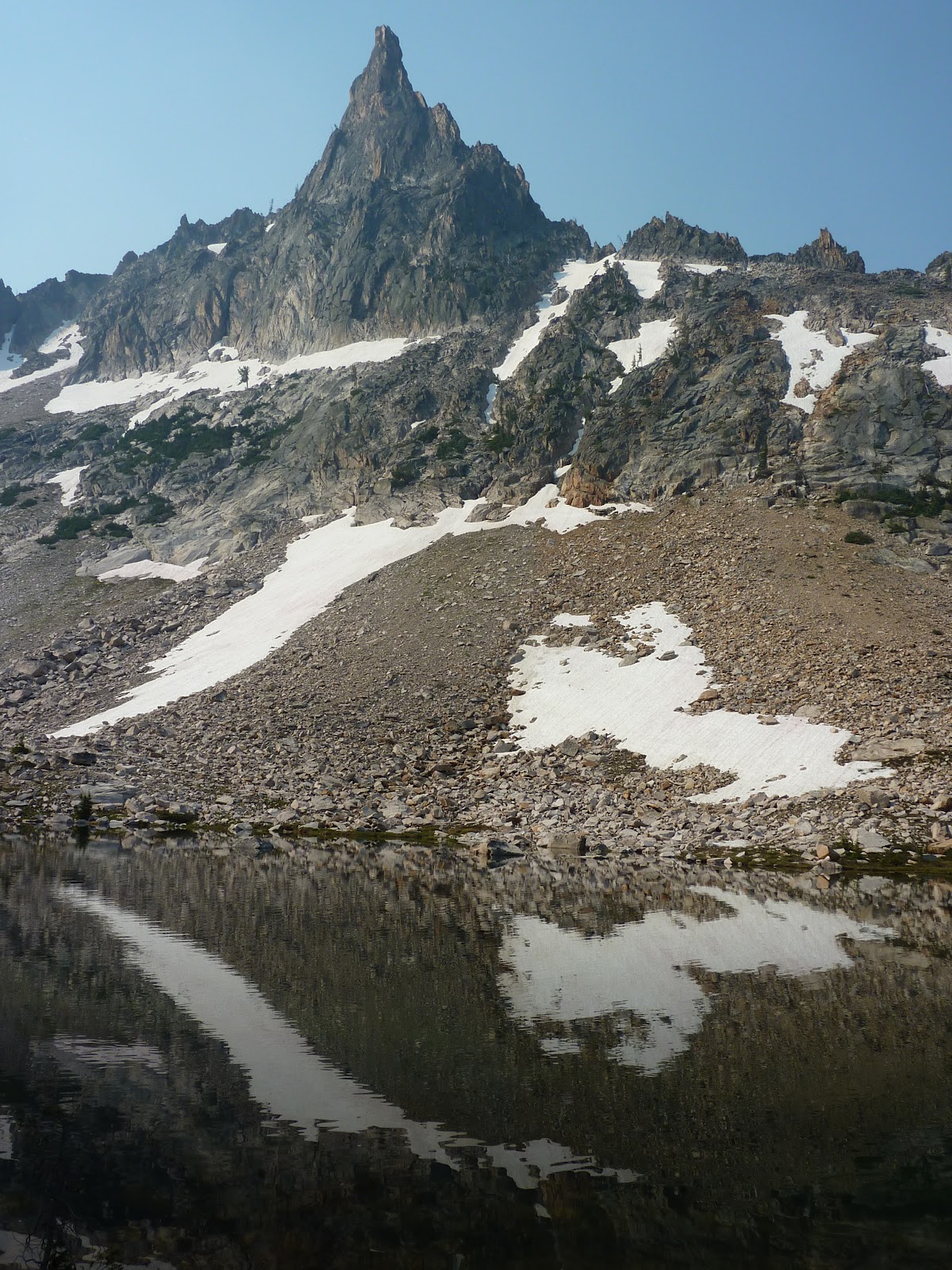
 Well I managed to find the true worst terrain in the known universe, a kind of cliff of quicksand, where I sunk in up to my ankles with every step, starting rock slides, slid and twisted, tried going down backwards,direct, traversing- nothing worked. It took me an hour to reach the Warbonnet Lakes. And all around me the sky was full of disgusting haze ruining all my shots, the few I took. But I was going to make it to Feather Lakes. That took only a few minutes more once hitting the Warbonnets. They might be pretty at sunrise for a few minutes, but mostly I think they are overated. All lakes in the Sawtooths have jagged peaks nearby. So why spend a day and a half killing yourself to reach these ones? Unless you are after a supreme challenge. Or going to climb Warbonnet, an idea of mine. Warbonnet was still miles off though, with more lakes to go, more hills of granite, more scree after, and then the actual climb. I was neither inclined nor in shape for it. So I walked the sides of the Feathers, and snacked and rested by Warbonnet Lakes, which I found more impressive, and then headed up...again.
Below are the Mayan Temple and several other peaks along the Feather Lakes on the less photogenic side. The haze is visible again.

 I still, after all this climbing and knowing where I was at last, nearly picked the wrong pass to climb to. Again the reason was: the actual way seemed inconceivably bad. It was a terrible trip down, though not so bad getting up from the Warbonnet Lakes. But then I spent more hours nearly breaking ankles and tripping and sliding and having rocks tumble after me down steep dry and wet nasty slopes. I let out some roars or pure alchemic rage which again shook the mountains and were only half-formed syllables, something like the letter "G", and if I had the energy, the next sound may have been close to "Zeus". But I was too out of breath to finish the curse, or the expression of amazement. How could terrain be so crummy so consistently and still be travelled by people willingly every year? The ice was better. The whole result was a disaster for me. I can't imagine ever going back, though there are amazing pics of the area. I think it would be better earlier in season when the peaks were more snow-covered. Ice is more stable than the rock in the area, if that is believable. But still, I got there, and that is something.
Back at Alpine Lake, I was ready to leave. I had a whole day plus half more to stay in Idaho if I wanted, but what else would I do? At this point I had done about 40 miles, lots of it up and down, had climbed 7 peaks, most of them impressive but not jaw-dropping, and chased storms, fled storms, been sun-bleached, been rained on, been spooked by animals, been amazed, let down, and everything inbetween. And with a month more hiking coming up, I figured, it was about time to head for home. But I was good and wise and rested 2 hours, eating, chugging fluids, and enjoying the idle pleasure of the Alpine Lake views. Packing slowly, stretching, prowling about in my muckluck slippers to let my shoes air out and give my feet a rest. I felt like a god, or a demi-god at least, who had escaped all of the modern world, like a time traveller who had not heard a phone or a horn or a car motor in a week. I was dirty, and glad to be done with all the hard stuff.
The pack was light on the way down now as most of my food was eaten and I wanted to make quick work to the boat shuttle. I decided to aim for the 7 pm and if I missed it, to camp near the dock for the 9 am next morning. I started at a little before 4. At 6, I was at the dock. I moved pretty shockingly fast for it being the end of the week, though it was all down hill, not pausing much and taking few pictures, though I did stop at some scenic falls and to view the creek a few times, as well as an impressive balanced rock. The sky was still hazy but more blue, and I began to doubt whether there were any fire actually. I made my boat and no one was panicking or said anything to me about a fire. When I got home, I found there were a few in the area, though nothing big or which started the night before. So that is still a mystery to me. Oh well. I ate a good dinner, got cleaned up a little and changed into clean non-hiking clothes, and then drove home starting at twilight.
More destiny of a rough sort seemed due me, as deer were trotting across the road at every bend, barely visible. I drove well under the speed limit or would have met any of five or so more personally than I wanted to. I had to stop at the Idaho border 4 hours later to sleep in the car for a bit. I woke the next morning after sunrise with a stiff neck, curled up in the backseat, happy, and laughing. Guess I needed the sleep.


 Well that wrapped up a mostly good trip. But its funny how a little rest changes perspective. Suddenly I was questioning myself as to why I did so little on the trip. Why did I let a mere 45-50 miles and 7 smallish peaks tucker me out and keep me off the good peaks and cliffs around the Feather Lakes? How did I get so lost? Am I really so clueless? Why did I not do more peaks, push through the fatigue? Depression came on as I drove home and ditzy people in big vehicles began swerving into my lane and making angry gestures at me for being there, as if I should know better and leave them the road. I did not like coming back to Utah where it was 80 F at 7 am. Where everything was even more hazy and had a scorched look. Coming back to the reality that is modern life with cars, electronics and all that. But its only for a week, and a good meal and a good rest put me in a better mood. I will just have to go back to the Sawtooths someday, and I have the rest of the summer to hike and hopefully will have fun doing so. The Feather Lakes I think I will skip though. That was a once in a lifetime experience I think. I had all the fun I could stand with them. But go find them if you want some grief or a challenge.
Larger versions of some pics, as well as others, including panoramas, are available for print or perusal at thestillwildwest.com. More stories will come when I am back from my next adventures. Thanks for reading.


