I am leaving after dinner tonight or first thing in the morning for my reboot trip to Washington. Even packed the car already and have a sort of plan. Mostly I am sticking with my summer theme: no plan, no reservations. But the basic idea is I will drive to Mt Rainier Park first (12.5 hrs) and do some easy hikes in the Tatoosh range for a day or 2, plus the Silver Forest, and hopefully see wildflowers and not go crazy with crowds. That breaks up the 15.5 hour drive to North Cascades National Park, where I will spend at least a week I hope, along with the Mt Baker area. I have 7-8 hikes/climbs penciled in and will see what looks good when I'm there. I also plan to drive the Mountain Loop Highway and scout for future trips, which will probably involve flying into Seattle, if there are any. With whatever time I have left I will head to Olympic National Park to do a few mountains and mainly hike the temperate rainforests. I have several ideas in mind there, but depending on energy level, and how things go, and weather, I may do them all or may not be able to. And there are lots of beaches to explore too, if I want. We'll see. I will be back if all goes well August 16 or 17 and will be doing shows again at that point. But I will only be printing pics of Montana or Washington by request. There were a few I really like from Idaho that I may have blown up and in stock. But perhaps not for a while.
Also, I am doing away with glass prints for now. I got a sample in the mail at last and am underwhelmed. The colors are odd and the amount of styrofoam, wood, and other materials involved in shipping make me uncomfortable at this time offering the product. I'd be producing a lot of trash and I pride myself on producing little, especially in how I eat, so I don't want to change that just to make a buck or two. Not that I've had any orders for glass prints yet, but that seems to be the going thing. I will look for another option and try another company at some point, if there is any interest by my adoring public. But until I know I can guarantee a good product, and ideally one that is somewhat not an environmental disaster, its out. Aluminum is still available and so are canvases. Those are quicker and easier to fulfill anyhow and both can be done approximately locally.
Triple Divide Peak, in Glacier, I should correct, is one of three "Triple Divide Peaks" in the USA. 2 are in California, however, and while taller and probably better climbs based on trip reports and pics I viewed, they are both much lamer in that they feed into 3 different watersheds in Cali, while Glacier's Triple technically feeds into 3 different oceans- which is what makes it special. However that is a bit of a stretch as you must trace hundreds of miles of rivers to reach the Arctic and count the Hudson Bay, which is only sometimes listed with the Arctic, though if it isn't the Arctic Ocean, the peak would still feed into the Atlantic, Pacific, and Hudson Bay, which is pretty cool too, no? The Continental Divide for those curious runs through the Rocky Mountains and is where on the east all water eventually feeds into the Atlantic and on the West all water feeds into the Pacific. There is a long Continental Divide Trail as well as the Great Western Trail. Both will take you from Mexico to Canada, and rival the Appalachian. I've done some of the Great Western here in Utah and it is often spectacular, and sometimes dull. But its a goal for some hearty folks. There is also the Pacific Crest and the Pacific Coastal Trail. You could spend your whole life going after Western mountains and never touch them all. Any peak along the Continental Divide feeds into 2 oceans and thus perhaps I am making too big a deal out of Triple Divide Peak on my questing list, as I would probably be short of water by reaching the top anyway, and I wonder how much water I'd really be willing to pour out to test the 3 paths to 3 oceans.
All for now. Here's hoping for a better trip. I've read that August is Washington's driest month and been told by former Washingtonians to expect to be dumped on by rain everyday. I'd settle for anything in the middle, and a drizzle now and again sounds great while sitting in Utah's heat.
Sunday, July 29, 2012
Saturday, July 28, 2012
Bacon Meatballs
More on Cut Bank, Montana, my trip to Glacier, and the actual hiking.
First, more on Cut Bank. I got stuck there for a weekend and it was deadly dull, and somewhat creepy, like being in a ghost town, with seemingly no one there. The local economy can't be doing well and they claim to be a gateway to Glacier, though its 70 miles away and there are several small towns much closer to Glacier. So probably they got cut out by recent development. Still, I was treated well by a motel owner, by every local I met, and by every car repair center I called, and the one I used. I went to a garage named Hegles's, which I want to say treated me well and got me in and out fast. I even got to help. So now I could do my own radiator if there is a next time. Let's hope that is unlikely as my car is old and I probably can't get 3-4 more years out of it and I want this radiator to last that long at least, like my previous one. The one before that went oh about 10 years I guess, which is very impressive for being used a lot. My mechanic had never done a Camry radiator before I could tell and that made it more helpful. He had to figure things out and stumble through a little, as I would. But putting it back together took 5 minutes, and I knew what I was doing too. Mostly I watched more than help, but either way, I learned. It took a little over an hour, and he was going to charge me $85 but I paid $100 as I appreciated being squeezed in so quick. Calling around and walking about at 8 am I was told Tues, Wed, Thurs, and Friday by every other shop. None of those were going to work. I'd already wasted a weekend there. Hegles had me come in 30 minutes later.
 So kudos to Cut Bank for being full of square-dealing men and women, and the town, though quaint, is cute. Not that I recommend you go there for your next vacation or anything. Dining was limited, with only a single cafe not including the words "and casino" on its sign. I avoid eating establishments that include "and casinos", which is hard in Montana, the state with the worst economy which would be bankrupt the past decade if not for subsidies from the Federal government, or so I read. So why are they all voting Republican exactly? "And casinos" generally will not be gourmet cuisine, though in Montana, I've found gourmet to be not such an option. More on that over on the other blog.
If you are ever in Cut Bank, tell them Giant Penguin sent you. This creepy cool statue sums the town up entirely. I think it was comissioned by the owners of 3 of the 4 local motels/hotels whose english is shall we say, secondary. They are good people, and I think they were intending the sign to mean "coolest place on earth", but they went with "coldest". Read what they mean, not what it says, I guess. I highly doubt Cut Bank is actually bragging about being the coldest place even in Montana, and especially as climate warms it. It was hot while I was there. My motel had ants on the walls, mold in the fridge, duct tape holding the door frame together and the door has probably been kicked in multiple times. There were loud people outside shouting at one another, there was a napkin taped to the blinds to cover a hole that someone had torn out of those blinds, but I got to check in at 10 am and stay for 2 days and it was only $40 per night, with free long-distance calls. And I had cell service, the outlets mostly worked, and I watched more TV in 2 days than in the past 2 years to kill time. I was in no mood for anything else. I watched a lot of redneck TV including a show where fat hunters shot bears for no reason, and then it cut away to a cooking show to prepare...fresh bacon meatballs. Not bear. I was surprised to say the least, and I don't think anything ever sounded worse than bacon meatballs. Ever. Or will. I'm confused as to the point to actually. I changed the channel, so I can't say more. And I should check my credit card statement before mentioning my promised free long-distance. I put that to use. The fellow who owned the place said in middle-eastern style english, and I paraphrase, "you could really me screw me with that offer at $40 a night". I sure hope I did not, because I did use my own phone plenty too. But what else was there to do Cut Bank Montana? Tell me that. I watched crappy Batman 3 once. I wasn't going to sit through crappy Spiderman too.
 For hiking, I did Avalanche Lake, which is extremely crowded and popular and not worth the trouble. Ugly and hazy and the waterfalls lure people in like a siren. I was more dedicated than most, and less stupid, though the cowards talking about fresh bear scat back at the shore didn't know that. I started heading into the woods and knew pretty quick if I were a bear I would bed down about there. Easy water access, flat terrain, heavy tall brush and grasses, good views, and escape routes. All other access was impassible but the main creek. I put on water shoes and fought the icy current for a few hundred yards but I'd have needed garden clippers to go further. I felt uncomfortable at one bend, knowing I was being watched, from above too. Strange I thought. I'd swear no bear was within miles. I'd bet my life on it..."excuse me mister! Does that go all the way to the waterfalls?" The voluptuous (I'm being generous) girls in bad footwear asked me from the dark of the steep slope above me well past the trail's end on a hopeless route I'd dismissed immediately. "No," I replied. And fought my way back through a tangle. A much better option near Avalanche Lake is to do the accessible paved "Trail of the Cedars" which takes in the only pretty thing in the area, Avalanche Gorge. The short loop has a bridge right over it. Snap a pic and move on. I got rushed in the parking lot by a line of SUVs overheating and drivers, also overheating. A nice woman asked if I was leaving, wanting my spot, but did not see any reason to mention to me I had things on my trunk. I folded up my map and drove away...I think there were things on my trunk. My water shoes and hat are still missing, so probably there were. Why wouldn't she say, oh by the way, you have stuff on your trunk? I hate Montanians. Except Cut Bankians.
 The next hiking I had opportunity for was early the following day. I had a mind to grab Rising Wolf Mountain, the most often climbed peak in Two Medicine, where I was, because I couldn't be anywhere else. Apparently I picked the busiest Tuesday in history and every campground was full by 2 pm. Mine was flooded, but I got up, not feeling well, but determined to start. The day turned out wonderful. I started early which made me wary of bears, but what made me more wary of bears was the park literature insisting to me that quiet, solo, and fast hikers were at especial risk and would be mauled, and that if they weren't, they would startle bears who would then panic, flee, and maul other hikers, especially children. So the day before I got all sorts of evil eyes, scoldings, and other commentary from noisy, fat, slow, overheated hikers, jingling bells, whistling, clapping hands, shouting, stomping feet, singing, yelling, blowing horns, and staying in dense packs that were hard to pass. I did pass though, silently and at high speed, wondering what all the anger was about, and finding out in evening when I read the farcical literature.
 Some notes on bears here: yes bears are dangerous, but they prefer not to meet people. Park bears know people equal death. These are intelligent animals. They can't do arithmetic, but frankly, neither can most of you. Not without your phone's help. They will avoid human contact whenever possible, as even the literature says so. As to hiking in groups, loudly and slowly- I have no idea how people manage not to hear me coming. I can hear most hikers from a mile off and I'm a little hard of hearing. But there are sounds that are obviously not wind or forest or water. These are hikers. Or animals. I do sneak up on deer a lot, so I guess I should worry, and I did clap entering groves of trees in early morning alone. But this nonsense with bells and horns is obsurd. Unless by water, a bear will hear you long before you mean the bear too. These are hunting animals. The strange mix of super powers and incompetence they get is strange to me. If they are so dangerous and strong and fast and amazing, then why exactly do we need to help them knowing we are there? Balderdash. Unless you are tiptoeing near a creek, the bear knows you are coming. They can also smell from miles away. I know because every park and wilderness requires bear containers or to hang food, promising bears can smell a candy bar from 4 miles against the wind. I think they can smell one sweaty man. And I had a defense baton and 13 inch bowie knife anyway. The few people I saw while hiking looked at me like a psycho, and were terrified of bears. I promise you this: if you are in the forest and your options are: clustering in a group with 20 scared people making comical noises, and one silent guy with a huge knife on his hip, and a steel collapsible baton on his other, pick the one guy when a bear comes. Animals behave predictably and can smell fear. It scares them. You can't trust cowards. They might do anything. But if a bear and I encounter one another, it will be very rational and predictable. He will huff, I will huff. I know how to huff trust me. Then we will fight or we won't. If we fight, I will lose if its a grizzly probably. Though when I told some people I thought my baton would do just fine, I did not mean I could knock a grizzly out. You give ground, you swipe at the paws and try to be a handful and not a threat at once. There's a chance. Bear fear is mostly another way of making money. The park sells bells, staffs, staffs with bells, whistles, horns, bear pepper spray, bear safety guides, bear containers, bear hanging gear, and everything else bear related you can think of. Sound like maybe they want to inflate the bear problem to create a new market? I'm being a cynic again.


 I took the trail to Dawson's Pass (6.5 miles), gave up on Rising Wolf (2.5 more miles to summit the way I came but along a long rocky ridge, then 2.5 back to this point- no safe shortcuts down), climbed Mt Helen instead- actually I started to make that decision about the moment I snapped the pic of Mt Helen above. Notice the lovely steep waterfall in center of the cliffs. Glacier has hundreds of those. That added 2 miles or more round trip of just a walk, but high altitude and uphill, and against an incredibly cold and strong wind blowing me off the mountain at 75 miles per hour maybe, and not letting up for a second. Froze my hands, and cut my finger open on one of the few rocks I tried. Stumbled into a herd of goats whose lookout was asleep or whom I was too skilled and silent for. We admired one another and I backed away before they could panic- lot of babies in the herd. Got some good hazy views, some lovely cloud play, and then went back to the pass to start up Flintsch's Peak, a famous horn carved by 3 glaciers near Rising Wolf.
 That was brutal and I met my first friend of the day, someone moving faster than me, but who was to finish by noon, so he could move faster than me. I had to save my strength. The terrain was terrible, steep, rocky, sliding, and eventually feeding into some dangerous jagged cliffs with glowing yellow lichen. I hated my way up and could not believe I was doing it, but I'd come this far...always a good reason to scream down your doubts. Tried a different route down and almost broke both legs probably, found myself in a very narrow crack, about stuck with a bad fall below me, and went back the way I came instead. Found a compromise. The wind was awful and I did not tarry to eat as planned. I'd also not drunk as the water I filtered at No Name Lake was terrible and I did not trust it. The cliffs all around were bright red and probably full of minerals. It would not kill me to drink for a day, but I was going to leave it for later when I absolutely needed it. I decided to finish a loop by taking a goat trail 4 miles to Pitamkin Pass near Mount Morgan. This is an awesome narrow trail made by goats in the side of a mountain the whole way, with amazing views and intense winds, but which blow one into the mountain. A nice change from near Dawson Pass and Flintsch Peak, where I was almost blown off those dangerous cliffs on top. I actually met some goats coming around a corner. A pair who looked at me with real surprise. Like "you're not a goat", and froze before giving me right of way. That was fun. Mount Morgan is a tough climb whose true summit requires climbing shoes, a partner, and or rope. I went 85 % of the way up but hit a band of cliffs too smooth and vertical to get back down without aid. So I counted it anyway. But to truly summit the peak, carry the extra gear, though that is unpleasant for 20+ miles and probably not worth it. The views are about the same from the bottom of the cliff band and other nearby peaks.

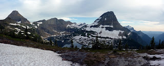
 From Mount Morgan one descends to any of several lakes. Old Man Lake to finish the Two Medicine Loop. Lots of people were on the trail now. A couple groups anyway. Most with packs doing it over 3 days. That made me feel rugged. One family was day-tripping it and a few others also, though without the peaks. And most started for Old Man Lake in the opposite direction I took. That is wiser sunwise, but less scenic. Old Man Lake is beautiful, or would be, right around sunset. I highly recommend if you can camping there. Permit required and unlikely in busy season. A mile of trail on several long switchbacks above the lake is a spectacular spot to watch the sunset, with the horn of Flintsch and some red cliffs behind, and lots of flowers, waving in the sky with the lake sparkling below. At mid-afternoon, the whole effect was washed out. (Can you spot the whole herd of goats in either of the pics looking back from Mt Helen to Flintsch? They are in there.)

Above is Mt Helen's long walk from somewhere on Flintsch Horn. Below are the final cliffs I climbed up to summit Flintsch. They are worse even than they look for once and were even worse on the way down. Did not have my climber shoes with me. The goat pic below was at a bend in the trail, an easy spot for us to navigate around one another conveniently. Mt Morgan's fortressy route up (actually as a horn there are 3 potential routes; all about equal) is the final pic in that group.


 The trail is 8 miles from Old Man Lake to the Two Medicine Campground, involves lots of up and down, little water, lots of exposure to the sun, heat, and the same ugly view all the way. Its a lousy trail, and was a tax on the rest of a great day. A bear was clearly living near the campground. I found scat 2 minutes after thinking a bear should live here- man do I know animals. It was clearly only a black bear though. Tiny scat equals tiny bear. The whole loop with peaks probably set a new record for me of about 23 miles and 3 peaks in one day. I took no rests longer than 15 minutes and regretted it after, with heat rash on my feet and ankles. But with wind and exposure to sun, there was no good place to relax for a bit, and I had to worry the time. It took me 13 hours which was faster than I expected and I had new friends sharing the campsite when I came back. Talked with some New Yorkers doing a lot of Western travel. Oh if only I'd stayed in Two Medicine another day. I almost did as the thought of a new campground was so awful, but I was already behind schedule.

 Twin Falls is a shorter trip along the same starting route I took. Its 7 miles round trip, or if using the boat, 3 miles round trip, plus $12 wasted per person. They are pretty enough, so far as waterfalls go. Rockwell Falls in Two Medicine is very popular and is gorgeous. I've seen pics. But the trail is 7.5 miles round trip and it was a very hot day the next day. The trail was not very promising with some dead trees and a lot of up and down, and without tying in nearby impressive and famous Mt Sinopah, pictured above in the sunrise photo with flowers, I did not think it worth the wear and tear on my legs. I was tired and had to waste all the mid day to find camping anyway. So I set off. (The two pics above are Old Man Lake from the ideal sunset spot and Young Man and Pitamkin Lake with another lake looking towards Cut Bank part of the park- not to be confused with the Cut Bank city area far off.)
 And later in the day after picking the KOA outside the park for simplicity's sake, my car blew heading up to Logan Pass for sunset- a poor sunset destination anyhow, by the way. Morning would be preferable light there, due to mountain layout. So I can't say it was worth it exactly, though I did hike to Hidden Lake Overlook anyway, and saw many goat families and baby goats, and the famous Bear Hat Mountain I still want to climb badly. Plus a herd of rams attacked in the parking lot. One followed me around like a trained pet which no one seemed to even notice. They just took pictures of us and probably editted me out. I was pretty impressed. Either this ram knows an alpha male when he sees one or else I smelled good (they do like antifreeze so I was told) or was the least excited person in the parking lot, and therefore the safest. The ram followed me as I weaved through cars, trotting after me, almost running sometimes, as I do walk fast, then ate bugs off my hood and drank my spilled coolant while I had gatorade. Then rangers came and yelled at me and everyone for frightening the animals and proceeded to charge, chase, and holler at the animals to chase them away, much to everyone's annoyance and amusement. Seeing an idiot in a stupid hat run full speed after a huge animal yelling "eeeeeeee-eeeeeeeee-eeeeee" and almost steering the beast into a speeding car coming around a blind corner...uh priceless. People are stupid though and were walking right up to these beasts with expensive Ipads and cameras on tripods, on the narrow road, not looking out for anything. Hundreds of people. Logan Pass...gotta hate it. But I did see lots of animals and get a story to tell. It put an end to my hiking though as the KOA people sent me to Cut Bank with much confidence, steering me off from Kalispell and telling me not to wait until Monday. Get it taken care of now, one woman thought in particular. And when I finally had a car I could trust again, I was out of the mood and the weather was hot and still rainy anyway. So I went home. With a moral to boot: never take the advice of anyone who lives in Montana. If they are so smart, then why do they live in Montana? Its the 50th ranked economy, the state with the most severe global warming effects, facing more droughts and fires than ever before, more haze, it gets super hot in summer now, is uglier every year, and shares all the inconveniences of Alaska with none of the riches or perks.


 Glacier is expensive and inconvenient, and I can't recommend it. Its tough to make any plan, tough to get around, the weather and crowds will waste at least 40% of the useable hours you have, and all in all, summer is not a good idea. Then again, I hear September is better and may try it again. I hate having unfinished business and I wanted to climb several peaks there for 2 years. It annoys me that tourists are given these mountains and not mountaineers, but Glacier can't sell me much and does not want me there. Its another Shangri-Nah of hiking. A place that promotes itself as a mecca so people come and buy tee-shirts. Actual hikers are just in the way.


Well, you know what the Canadians have said for centuries: It isn't having a bad week or blowing $1,000 that gets you, its paying $1,000 to have one of the worst weeks of your life. If you have to go north so bad to see mountains, maybe try Banff in Canada. I bet its less crowded. I also hear good things about the Canadian side of the Glacier area: Waterton Lakes. Actually its an international park now, as the two joined. Local Montanans all told me to go to Waterton. But that is even farther from anything. Just so you know. Petting zoos and state fairs are a cheaper and easier way to see wildlife, though not wild. And it would be hard to have worse luck than I did. And I will probably go back, and I am already starting to remember things more fondly, looking at these pictures. They sure do make the area look awful pretty. Below is Rising Wolf, somehow, impossible to pick out from below, but obvious and fabulous from every angle below and "above". Here is the long ridge walk I'd have had to take to get there. Even the haze can be editted out of many photos. I used my skills. And mostly, software. Well, more eventually, when I am back from Washington, hopefully in a better mood.

First, more on Cut Bank. I got stuck there for a weekend and it was deadly dull, and somewhat creepy, like being in a ghost town, with seemingly no one there. The local economy can't be doing well and they claim to be a gateway to Glacier, though its 70 miles away and there are several small towns much closer to Glacier. So probably they got cut out by recent development. Still, I was treated well by a motel owner, by every local I met, and by every car repair center I called, and the one I used. I went to a garage named Hegles's, which I want to say treated me well and got me in and out fast. I even got to help. So now I could do my own radiator if there is a next time. Let's hope that is unlikely as my car is old and I probably can't get 3-4 more years out of it and I want this radiator to last that long at least, like my previous one. The one before that went oh about 10 years I guess, which is very impressive for being used a lot. My mechanic had never done a Camry radiator before I could tell and that made it more helpful. He had to figure things out and stumble through a little, as I would. But putting it back together took 5 minutes, and I knew what I was doing too. Mostly I watched more than help, but either way, I learned. It took a little over an hour, and he was going to charge me $85 but I paid $100 as I appreciated being squeezed in so quick. Calling around and walking about at 8 am I was told Tues, Wed, Thurs, and Friday by every other shop. None of those were going to work. I'd already wasted a weekend there. Hegles had me come in 30 minutes later.

If you are ever in Cut Bank, tell them Giant Penguin sent you. This creepy cool statue sums the town up entirely. I think it was comissioned by the owners of 3 of the 4 local motels/hotels whose english is shall we say, secondary. They are good people, and I think they were intending the sign to mean "coolest place on earth", but they went with "coldest". Read what they mean, not what it says, I guess. I highly doubt Cut Bank is actually bragging about being the coldest place even in Montana, and especially as climate warms it. It was hot while I was there. My motel had ants on the walls, mold in the fridge, duct tape holding the door frame together and the door has probably been kicked in multiple times. There were loud people outside shouting at one another, there was a napkin taped to the blinds to cover a hole that someone had torn out of those blinds, but I got to check in at 10 am and stay for 2 days and it was only $40 per night, with free long-distance calls. And I had cell service, the outlets mostly worked, and I watched more TV in 2 days than in the past 2 years to kill time. I was in no mood for anything else. I watched a lot of redneck TV including a show where fat hunters shot bears for no reason, and then it cut away to a cooking show to prepare...fresh bacon meatballs. Not bear. I was surprised to say the least, and I don't think anything ever sounded worse than bacon meatballs. Ever. Or will. I'm confused as to the point to actually. I changed the channel, so I can't say more. And I should check my credit card statement before mentioning my promised free long-distance. I put that to use. The fellow who owned the place said in middle-eastern style english, and I paraphrase, "you could really me screw me with that offer at $40 a night". I sure hope I did not, because I did use my own phone plenty too. But what else was there to do Cut Bank Montana? Tell me that. I watched crappy Batman 3 once. I wasn't going to sit through crappy Spiderman too.
 For hiking, I did Avalanche Lake, which is extremely crowded and popular and not worth the trouble. Ugly and hazy and the waterfalls lure people in like a siren. I was more dedicated than most, and less stupid, though the cowards talking about fresh bear scat back at the shore didn't know that. I started heading into the woods and knew pretty quick if I were a bear I would bed down about there. Easy water access, flat terrain, heavy tall brush and grasses, good views, and escape routes. All other access was impassible but the main creek. I put on water shoes and fought the icy current for a few hundred yards but I'd have needed garden clippers to go further. I felt uncomfortable at one bend, knowing I was being watched, from above too. Strange I thought. I'd swear no bear was within miles. I'd bet my life on it..."excuse me mister! Does that go all the way to the waterfalls?" The voluptuous (I'm being generous) girls in bad footwear asked me from the dark of the steep slope above me well past the trail's end on a hopeless route I'd dismissed immediately. "No," I replied. And fought my way back through a tangle. A much better option near Avalanche Lake is to do the accessible paved "Trail of the Cedars" which takes in the only pretty thing in the area, Avalanche Gorge. The short loop has a bridge right over it. Snap a pic and move on. I got rushed in the parking lot by a line of SUVs overheating and drivers, also overheating. A nice woman asked if I was leaving, wanting my spot, but did not see any reason to mention to me I had things on my trunk. I folded up my map and drove away...I think there were things on my trunk. My water shoes and hat are still missing, so probably there were. Why wouldn't she say, oh by the way, you have stuff on your trunk? I hate Montanians. Except Cut Bankians.
 Some notes on bears here: yes bears are dangerous, but they prefer not to meet people. Park bears know people equal death. These are intelligent animals. They can't do arithmetic, but frankly, neither can most of you. Not without your phone's help. They will avoid human contact whenever possible, as even the literature says so. As to hiking in groups, loudly and slowly- I have no idea how people manage not to hear me coming. I can hear most hikers from a mile off and I'm a little hard of hearing. But there are sounds that are obviously not wind or forest or water. These are hikers. Or animals. I do sneak up on deer a lot, so I guess I should worry, and I did clap entering groves of trees in early morning alone. But this nonsense with bells and horns is obsurd. Unless by water, a bear will hear you long before you mean the bear too. These are hunting animals. The strange mix of super powers and incompetence they get is strange to me. If they are so dangerous and strong and fast and amazing, then why exactly do we need to help them knowing we are there? Balderdash. Unless you are tiptoeing near a creek, the bear knows you are coming. They can also smell from miles away. I know because every park and wilderness requires bear containers or to hang food, promising bears can smell a candy bar from 4 miles against the wind. I think they can smell one sweaty man. And I had a defense baton and 13 inch bowie knife anyway. The few people I saw while hiking looked at me like a psycho, and were terrified of bears. I promise you this: if you are in the forest and your options are: clustering in a group with 20 scared people making comical noises, and one silent guy with a huge knife on his hip, and a steel collapsible baton on his other, pick the one guy when a bear comes. Animals behave predictably and can smell fear. It scares them. You can't trust cowards. They might do anything. But if a bear and I encounter one another, it will be very rational and predictable. He will huff, I will huff. I know how to huff trust me. Then we will fight or we won't. If we fight, I will lose if its a grizzly probably. Though when I told some people I thought my baton would do just fine, I did not mean I could knock a grizzly out. You give ground, you swipe at the paws and try to be a handful and not a threat at once. There's a chance. Bear fear is mostly another way of making money. The park sells bells, staffs, staffs with bells, whistles, horns, bear pepper spray, bear safety guides, bear containers, bear hanging gear, and everything else bear related you can think of. Sound like maybe they want to inflate the bear problem to create a new market? I'm being a cynic again.

 I took the trail to Dawson's Pass (6.5 miles), gave up on Rising Wolf (2.5 more miles to summit the way I came but along a long rocky ridge, then 2.5 back to this point- no safe shortcuts down), climbed Mt Helen instead- actually I started to make that decision about the moment I snapped the pic of Mt Helen above. Notice the lovely steep waterfall in center of the cliffs. Glacier has hundreds of those. That added 2 miles or more round trip of just a walk, but high altitude and uphill, and against an incredibly cold and strong wind blowing me off the mountain at 75 miles per hour maybe, and not letting up for a second. Froze my hands, and cut my finger open on one of the few rocks I tried. Stumbled into a herd of goats whose lookout was asleep or whom I was too skilled and silent for. We admired one another and I backed away before they could panic- lot of babies in the herd. Got some good hazy views, some lovely cloud play, and then went back to the pass to start up Flintsch's Peak, a famous horn carved by 3 glaciers near Rising Wolf.
 That was brutal and I met my first friend of the day, someone moving faster than me, but who was to finish by noon, so he could move faster than me. I had to save my strength. The terrain was terrible, steep, rocky, sliding, and eventually feeding into some dangerous jagged cliffs with glowing yellow lichen. I hated my way up and could not believe I was doing it, but I'd come this far...always a good reason to scream down your doubts. Tried a different route down and almost broke both legs probably, found myself in a very narrow crack, about stuck with a bad fall below me, and went back the way I came instead. Found a compromise. The wind was awful and I did not tarry to eat as planned. I'd also not drunk as the water I filtered at No Name Lake was terrible and I did not trust it. The cliffs all around were bright red and probably full of minerals. It would not kill me to drink for a day, but I was going to leave it for later when I absolutely needed it. I decided to finish a loop by taking a goat trail 4 miles to Pitamkin Pass near Mount Morgan. This is an awesome narrow trail made by goats in the side of a mountain the whole way, with amazing views and intense winds, but which blow one into the mountain. A nice change from near Dawson Pass and Flintsch Peak, where I was almost blown off those dangerous cliffs on top. I actually met some goats coming around a corner. A pair who looked at me with real surprise. Like "you're not a goat", and froze before giving me right of way. That was fun. Mount Morgan is a tough climb whose true summit requires climbing shoes, a partner, and or rope. I went 85 % of the way up but hit a band of cliffs too smooth and vertical to get back down without aid. So I counted it anyway. But to truly summit the peak, carry the extra gear, though that is unpleasant for 20+ miles and probably not worth it. The views are about the same from the bottom of the cliff band and other nearby peaks.


Above is Mt Helen's long walk from somewhere on Flintsch Horn. Below are the final cliffs I climbed up to summit Flintsch. They are worse even than they look for once and were even worse on the way down. Did not have my climber shoes with me. The goat pic below was at a bend in the trail, an easy spot for us to navigate around one another conveniently. Mt Morgan's fortressy route up (actually as a horn there are 3 potential routes; all about equal) is the final pic in that group.


 The trail is 8 miles from Old Man Lake to the Two Medicine Campground, involves lots of up and down, little water, lots of exposure to the sun, heat, and the same ugly view all the way. Its a lousy trail, and was a tax on the rest of a great day. A bear was clearly living near the campground. I found scat 2 minutes after thinking a bear should live here- man do I know animals. It was clearly only a black bear though. Tiny scat equals tiny bear. The whole loop with peaks probably set a new record for me of about 23 miles and 3 peaks in one day. I took no rests longer than 15 minutes and regretted it after, with heat rash on my feet and ankles. But with wind and exposure to sun, there was no good place to relax for a bit, and I had to worry the time. It took me 13 hours which was faster than I expected and I had new friends sharing the campsite when I came back. Talked with some New Yorkers doing a lot of Western travel. Oh if only I'd stayed in Two Medicine another day. I almost did as the thought of a new campground was so awful, but I was already behind schedule.
 Twin Falls is a shorter trip along the same starting route I took. Its 7 miles round trip, or if using the boat, 3 miles round trip, plus $12 wasted per person. They are pretty enough, so far as waterfalls go. Rockwell Falls in Two Medicine is very popular and is gorgeous. I've seen pics. But the trail is 7.5 miles round trip and it was a very hot day the next day. The trail was not very promising with some dead trees and a lot of up and down, and without tying in nearby impressive and famous Mt Sinopah, pictured above in the sunrise photo with flowers, I did not think it worth the wear and tear on my legs. I was tired and had to waste all the mid day to find camping anyway. So I set off. (The two pics above are Old Man Lake from the ideal sunset spot and Young Man and Pitamkin Lake with another lake looking towards Cut Bank part of the park- not to be confused with the Cut Bank city area far off.)


Glacier National Park: The Disney World of Mountains
No that is not a compliment.

 We have a new contestant in the most not-worth-it thing I've ever done competition. Driving to Glacier National Park. The drive is long, ugly, boring, and into the middle of nowhere. Global warming has severely damaged the park. So have pine beetles. And fires. West Glacier you will hear is a beautiful heavily forested area of rolling hills with views into the rocky peaks to the west. That is probably a good quote, but read the year its attached to. Probably someone like John Muir from about 1917. Lot of old quotes of old dead famous people are posted in parts of Glacier. You know, back when there were glaciers and only a few lodges. Well I drove through West Glacier and saw a lot of scorched trees, then I hiked it, and went through many miles of pine beetle feasting grounds. The same sort I posted pics of for my Elegy for the Uintas. Don't ask me for any more pics of dead pine trees. You see 5 million, you've seen them all. West Glacier is lousy and ugly and will be for at least the next decade. Probably the next millenia. However, if you want to stay during peak season within 100 miles of any part of Glacier you'd like to be, the West Glacier Lodge is a good choice. Its cute, cheap (by National Park lodge standards), quiet, and access to the public shuttle system along "Going to the Sun Road" is divided somewhat nonsensically into East and West, with a transfer at the top at "Logan Pass". So if you want to try that shuttle, start from the West or you will have long waits, long lines, and little time to do anything or see anything all day other than the backs of other bored and frustrated people and the dark clouds swooping in to soak you or blast you with wind.
 Ah Glacier- you know all those pictures you see of fields of flowers, staggeringly bright sparkling towers of rock, horns, elegant spires, and the like? Endless brilliant emerald fields of grass? Sparkling lakes? Yeah, that happens probably 3 days per year now. Most of those pictures are old. The best Glacier picks I've seen are from before 2002, which concerned me- it certainly did- but which I wrote off. Well, just to warn you, you need to know that it rained or was cloudy somewhere in the park every single day I was there, and especially at Logan Pass, the most popular part of the park. Also know that Logan Pass is surrounded and sheltered by peaks and will only bloom for a few weeks each year. Good luck not living locally and timing your trip right. Most of the park was starting to dry out and the snow was all gone in my week there, but Logan Pass was still an ugly mess, barely thawing. So it was a double jip. And of the 3 times I visited Logan Pass, one I was inside a cloud, one time horrifying black clouds were coming, which caused flash flooding 2 hours later and washed away much of the "Going to the Sun" road, trapping people or making them take an extra 100 miles to get back to West Glacier. And the third trip up was beautiful, sort of, but hazy, with a dull sunset, bear threats, baby goats galore, and all in all, it was worth the hike. Even though the hiking there is on board walks and is astonishingly crowded with annoying people out of their element, peeing themselves at every wind or bird call, with shouts of "bear! Dad a bear!" and such. It is usually not a bear, though a mother was denning up for the summer with her cubs near Hidden Lake, a premium destination of Logan Pass, and did threaten some idiots taking photos of the babies and getting to close. I had to explain to a few people the behavior of bears: if a den isn't secret, its useless. Its a trap and a slaughter ground. So that's why she kept charging you when all you wanted was to see where they were living." God people scare me. I missed these wild bears and some fighting marmots due to my car issues. Sigh. All I got was baby goats on camera.
 "Going to the Sun" road is an engineering marvel and well worth seeing. Good luck with that. In peak season and middle day especially you will lose hours sitting on steep slopes with your engine overheating waiting for mile long lines of tourists, and dangerous construction at the edge of lovely abysses. Its a mixed experience. Avoid middle of the day, and do not take the shuttle. A word on the shuttle- I tried it once after my radiator leaked, dried out, overflowed, blew, and cracked (which apparently was entirely my fault by the way as I was spoken to like a pathetic idiot by rangers and everyone employed by Glacier who I bothered talking to- personally I felt pretty bad-ass for having extra coolant with me, like I always do, a funnel to pour it without spilling, duct tape to patch the crack- okay Bar's Leak would have been more useful, but still- and for then being able to drive with the heater on for 100 miles to the nearest car repair center- more on that later, with no further problems and without once panicking or raising my voice)- and I am convinced the budget is kept low to make the shuttle intentionally bad. Now you may call me a cynic, but Glacier operates a paid tour-bus system called the "Red Bus" line; cool old-fashioned Rolls Royce stretch limo things that are bright red and cost $17 and fill up fast. They are driven by nice people in bow-ties and vests who say things over to you on a microphone, such as "here is Jackson Glacier...which Montana's congressmen are presently spending millions of dollars to debate over as to whether it is a glacier or a seasonal snow-field due to climate change not related to global warming or local mining in any way." Charming. And rather expensive if a decent free shuttle were available. Do you see why it might be in the interests of the park to offer a free shuttle, but not a good one? One hour waits at bus stops and then being told: "yes there are 22 seats, but I am required to keep 11 open at all times when I leave this first stop to allow for others at later stops to come aboard" is not good business. I spoke with the director of the system who was annoyed he gets negative reviews. His opinion was mostly that people are whiny, entitled, and unrealistic. Its a VERY narrow, busy road under construction and thousands of people daily are going to the same small parking lot on the side of a high mountain to hike the same 3 trails. There will be problems, especially when storms move in and everyone wants to leave at the same instant. Fair enough. But I got to the bus station at 8:45 am- too late I know, and had to wait until 9:15 for a bus to show, until 9:30 for the driver to be ready to roll, until 9:40 for 9 people to volunteer to wait for the next bus because 11 seats had to be left open for other passengers...um? Strange, when standing is allowed. It took 1 hour to travel 20 miles due to lots of stops where no one got on or off. Then once at Logan Pass we could not see 3 feet before our faces, so everyone wanted to go down, and guess what? I had to wait 90 minutes to be able to, and it took another hour to get back. That is not good public transit. You might as well not offer it. And I'm sure the Red Bus line could not agree more. They do take credit cards, by the way.
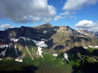
 The above photo is Hidden Lake overlook at Logan Pass, with the fabulous and frequently climbed Mt Reynolds at left- a climb I wanted to do- and rarely climbed Bear Hat to the right- an amazing mountain I've had earmarked for 2 years. And still do. Rangers I asked not only were unwilling to register me to climb it, but did not even know how to as they had no idea what peak I was talking about. Seriously.
So there are probably 3 good days of weather per year. Logan Pass is especially unpredictable and you could never pay me to drive that road again. My friend who directs the bus line got in a fever when I back-hand complimented the construction along the road, saying, "I was amazed not only by the road but that construction can be done while thousands of cars pass inches away without even looking because the road curves, they are scared or distracted (nice views) and probably texting and taking pics, and are incompetent at driving anyway to begin with in normal situations." This is apparently a sore spot as road construction recently took a PR hit when a worker fell 200 some feet and nearly died, and because this is year 7 in a $800,000,000 project that was originally supposed to take 3 years and cost $200,000,000 but was violently opposed by the local businesses who said having only sections of the road open would destroy tourism and ruin their lives. That is probably true, though my friend did not agree. Trust me I thought, no one is driving all the hell of the way through Montana to visit this place if only 66% of the park is open. No way. Tourists want to see it all. While sipping a soda, at 100 miles per hour. So I understand why they are doing it the way they are. I do. But I fully expect it is being done wrong enough that the construction will never end. And more cars will blow up near Logan Pass idling on hills, like the blonde girls I saw on my first day at the park, when I thought, "this day is going bad, but at least my car did not explode at the top of Logan Pass". They by the way had a parade of men helping them. When mine blew? Cars pulled up next to me and took pictures of animals through me. Clearly, no one cared. They did not care, squared. So luckily for me, I was prepared enough. I mean I didn't have a spare radiator in the trunk, which the rangers seemed to think I ought to have had, but I managed alone. Screw all of you who were in Glacier the same week as me. I hate you all, by the way. How about asking if I'm fine, or offering to follow me down? Or suggesting to me where I need to go for car repairs, you locals? Global warming makes the sky hazy, really hazy on good days now, at least in summer with all the car fumes, and its hot, and the mountains are dry and ugly with tiny little snow patches comically still called glaciers. But it is damn pretty if you aren't being struck by lightning, none the less.
Glacier is now on the whole pretty much an amusement park. Lines, waits, lines to wait to park, (seriously after 10 am do not expect to park without the help of a surly cocky ranger in sunglasses and on a walkie talkie with another surly cocky ranger who will then waive cones at you to direct you to your parking space). This will go on until 5 pm or so when every restaurant of mediocre Montana cooking will fill up for 500 miles if you are hungry, which I hope you are not. Probably you won't be because you'll have spent most of the day even if starting at 6 am, looking for parking, rather than hiking, or waiting for a shuttle. Because if you start a trail at 6, finish around 11, and want to start another, guess what- you can't. The rest of the day is useless. So you should probably have good lodging. Camping is useless, difficult, and expensive, at $20 per day if you want water, or $10 in primitive grounds, where you fend for yourself and need a purifier. Reservations are not generally taken for the campgrounds (2 take them up to a year in advance) and if you want a site you may have to visit several, driving in circles looking for an open one. I spent 2 hours my first day there doing this, got the last spot in the last circle I checked, put 100 miles on the car driving between all these awful grounds, and got flooded because it started to pour immediately. The people next to me came back from a hike to find their tent in 6 inches of water as a pond had formed. Sucks for them, but luckily they were already wet as the wife blamed the husband for all of it. He must have been one of those rain gods Doug Adams wrote about in his books. I covered West Glacier, so here is your guide to the east: There is East Glacier, an adorable town consisting of 3 diners, 2 lodges, all charming, and 5 billboards that range in their subject from "huckleberry pie" to "Huck!" with a painting of some huckleberries and a pie slicer. I kid you not. Also if you stay there you will have a 50 mile drive to get to the popular regions of the park where hiking semi-exists, and this will take you near an hour.

Two Medicine is a cool sort of sub park that gets low notes for "being just park" as the rangers say. They don't have any amenities or touristy stuff at all! Can you believe it? Gasp with horror. All they have is a 1 hour boat tour of the lake (expensive as hell even by expensive as hell boat tour standards), and its a small lake by the way. And a campground with flush toilets, electricity, running water, noise galore, fishing, and 400 signs warning you bears will ruin your life if you set down your piece of huckleberry pie for even a second- and $50 citations which apparently pay the salaries of aggressive campground managers. Also a little restaurant and a huge general store, and a boat dock, and a parking lot guarded by armed rangers on walkie talkies. But that's it! The rangers practically told half the people coming to leave with a chuckle. "Oh you won't like Two Medicine," they assured cars of the curious. "There's virtually nothing here but forest. You don't look rugged enough to last here." You can't make this stuff up. Why would I even try? There is excellent hiking here however, with lots of lakes, cool peaks, windy passes, wildlife, flowers, less crowds, and awesome hazy views. That will be a separate post where I go over the trails I tried. Running Eagle, or Trick Falls, is handicapped accessible in Two Medicine and along a very short trail. It is sometimes a double falls and sometimes a single. Pictured above.
On an annoyingly winding road through savage burn areas is the Cut Bank region of the park, down a 5 mile dirt road (passable from what I saw to 2 wheel drive vehicles, with primitive camping that usually will not fill up. Water is available nearby at a creek and hiking has several options with Amphitheatre Mountain (hard to reach but amazing views from what I've seen of an amazing peak called Split Mountain), Mount James (easy as far as Glacier goes according to my climber's book, but still with rotten rock and scree and danger and annoyance) and the fabulous Triple Divide Peak I looked forward to for years and am bitter to not climb on this trip, as it is a special mountain. If you pour water out on top, it will flow in three directions because the summit is on the Continental Divide and actually feeds into 3 different continental watersheds. No other peak I have heard of can claim this. The climb is said to be tedious, dangerous, and on awful rock, though mostly just a steep walk. There are a few lakes but not much else I noticed on the map. Only the rugged need go. One backcountry campsite is located strategically to attack those 3 peaks, but otherwise you are looking at a 20+ mile roundtrip day to Cut Bank campground, and few would be up to it, honestly. The back-country site fills up regularly as it is central on a long several day hike route that is popular. Also those kind of backpackers take priority to one-night-stand campers, so I was basically laughed at when I inquired about getting a pass there. The message I took home from this is what most serious mountain people I know have already decided for themselves: if going to Glacier, go rogue, because dealing with the infrastructure and the rangers is not worth it. And Glacier does not want you there anyway. Right near Cut Bank road I came on a crowd of photographers setting up tripods to snap pics of wild horses in front of Mt James and Triple Divide Peak. It was amusing as 50 cars came out of nowhere with that photographer's sense of doing what the competition is. They all parked in a rush, staked a spot, and fought for those hazy pics of horses in a field of scorched flowers. Hey I did too. The best pic is below and the central peak is Triple Divide. Mt James looms large just near the edge on the right. The two share a pass, where they are climbed from.
 Near the "Going to the Sun Road" is St Mary, a town whose motto is, according to several locals I spoke with, "if you want it, you'll pay for it." This is a 2 month per year town that shuts down from October through late June, with a gas station, some stores, many lodges and campgrounds, and prices that make gougers proud. Hey it is middle of nowhere, so cut them some slack. Not in St Mary however is: decent food, a single person who knows the area at all, any towing or automotive service whatsoever. Strange, if you ask me. I would avoid St Mary personally. However, if you want to camp outside the park, this is the best option. Johnson's is about on par with the park itself; $20 per night, though they fill up only after the official campgrounds do in general. And you pay taxes so its a bit more. Locally owned. And there is a KOA for $33 plus tax, with a pool, hot tub, and all the entertainment that drunken University of Washington students can bring while having all male chicken fights in a pool during a rainstorm. If you are into that sort of thing. The pool is a very nice feature. I thought the hot tub would help my legs hold up to the rigours of hiking, but instead, I used both to ease my epic boredom while not hiking, due to weather, car, and crowd problems.
Many Glacier is the most popular east side option I hear. 2 hotels, one reasonable, and one outlandish, a campground that you couldn't get into if your parents had tried to make reservations before you were born during peak season, popular trails, secret goat trails, famous peaks, eating, bus tours, and all that. I never got there this trip, due to the car. An expensive shuttle does go there a few times a day from St Mary but its expensive even by rip-off national park standards. However, it will at least show up at set times. The nearby town of Babb is a moderny piece of trash thrown up to look old fashioned like if the Old West were made of cardboard and stucco. I'm not sure why its there, actually. Near Babb you can, if desperate, go camping at Duck Lake, a few miles further from the park.
Other nearby towns are on the West: Whitefish or Kalispell. Kalispell is actually a year-round city, with several grocery stores and multiple streets. If you have car trouble, get here if you can. Its 30 miles from the West end of the park, meaning 60 or so from Logan Pass, mostly downhill or flat. But if your tent is over on East Glacier, you're boned as they say, because the two nearest towns are Browning, and Cut Bank. Browning is terrifying. Though one of the highlights of my trip sadly was hearing a creepy old man try to flirt with a whorish woman by asking for a light. He expected her to walk across the gas station to light him up, while she insisted he take the 10 steps to her to get a light. I got the hell out of there quickly, and had to, as there is no car service in Browning either. Unless you want your oil changed in someone's backyard. The town is mostly silver bullet trailers dumped at strange angles and half sunk into mud like ships going under in a huge plain. Cut Bank has a small mall, 75 casinos, a movie theatre which is extremely clean with good seats, a few hotels, most of them owned by one family, a well-stocked, sparkling grocery store with reasonable prices and excellent selection, a McDonald's, a freight train passing through every hour, a fun center that had rollerskate disco taking place my Saturday in town, and one hell of a big creepy penguin statue.


I was sent on local advice to Cut Bank to pick up a radiator that was overnighted at darn good price ($104) from I assume, Great Falls, 100 miles south. Unfortunately, the same stupid locals did not mention I was picking this up at a store, not a store/garage, and that every garage (12!!!!) in town would be closed until Monday. So I wasted a weekend sitting in a motel room with ants on the wall in Cut Bank, Montana, being annoyed with Montanians. More on this in the next post because this is getting very long. To close, here are some pics of flowers up close, which came out good. More pics and stories in the next blog about Glacier. And lots more on Cut Bank Montana.

 We have a new contestant in the most not-worth-it thing I've ever done competition. Driving to Glacier National Park. The drive is long, ugly, boring, and into the middle of nowhere. Global warming has severely damaged the park. So have pine beetles. And fires. West Glacier you will hear is a beautiful heavily forested area of rolling hills with views into the rocky peaks to the west. That is probably a good quote, but read the year its attached to. Probably someone like John Muir from about 1917. Lot of old quotes of old dead famous people are posted in parts of Glacier. You know, back when there were glaciers and only a few lodges. Well I drove through West Glacier and saw a lot of scorched trees, then I hiked it, and went through many miles of pine beetle feasting grounds. The same sort I posted pics of for my Elegy for the Uintas. Don't ask me for any more pics of dead pine trees. You see 5 million, you've seen them all. West Glacier is lousy and ugly and will be for at least the next decade. Probably the next millenia. However, if you want to stay during peak season within 100 miles of any part of Glacier you'd like to be, the West Glacier Lodge is a good choice. Its cute, cheap (by National Park lodge standards), quiet, and access to the public shuttle system along "Going to the Sun Road" is divided somewhat nonsensically into East and West, with a transfer at the top at "Logan Pass". So if you want to try that shuttle, start from the West or you will have long waits, long lines, and little time to do anything or see anything all day other than the backs of other bored and frustrated people and the dark clouds swooping in to soak you or blast you with wind.


So there are probably 3 good days of weather per year. Logan Pass is especially unpredictable and you could never pay me to drive that road again. My friend who directs the bus line got in a fever when I back-hand complimented the construction along the road, saying, "I was amazed not only by the road but that construction can be done while thousands of cars pass inches away without even looking because the road curves, they are scared or distracted (nice views) and probably texting and taking pics, and are incompetent at driving anyway to begin with in normal situations." This is apparently a sore spot as road construction recently took a PR hit when a worker fell 200 some feet and nearly died, and because this is year 7 in a $800,000,000 project that was originally supposed to take 3 years and cost $200,000,000 but was violently opposed by the local businesses who said having only sections of the road open would destroy tourism and ruin their lives. That is probably true, though my friend did not agree. Trust me I thought, no one is driving all the hell of the way through Montana to visit this place if only 66% of the park is open. No way. Tourists want to see it all. While sipping a soda, at 100 miles per hour. So I understand why they are doing it the way they are. I do. But I fully expect it is being done wrong enough that the construction will never end. And more cars will blow up near Logan Pass idling on hills, like the blonde girls I saw on my first day at the park, when I thought, "this day is going bad, but at least my car did not explode at the top of Logan Pass". They by the way had a parade of men helping them. When mine blew? Cars pulled up next to me and took pictures of animals through me. Clearly, no one cared. They did not care, squared. So luckily for me, I was prepared enough. I mean I didn't have a spare radiator in the trunk, which the rangers seemed to think I ought to have had, but I managed alone. Screw all of you who were in Glacier the same week as me. I hate you all, by the way. How about asking if I'm fine, or offering to follow me down? Or suggesting to me where I need to go for car repairs, you locals? Global warming makes the sky hazy, really hazy on good days now, at least in summer with all the car fumes, and its hot, and the mountains are dry and ugly with tiny little snow patches comically still called glaciers. But it is damn pretty if you aren't being struck by lightning, none the less.
Glacier is now on the whole pretty much an amusement park. Lines, waits, lines to wait to park, (seriously after 10 am do not expect to park without the help of a surly cocky ranger in sunglasses and on a walkie talkie with another surly cocky ranger who will then waive cones at you to direct you to your parking space). This will go on until 5 pm or so when every restaurant of mediocre Montana cooking will fill up for 500 miles if you are hungry, which I hope you are not. Probably you won't be because you'll have spent most of the day even if starting at 6 am, looking for parking, rather than hiking, or waiting for a shuttle. Because if you start a trail at 6, finish around 11, and want to start another, guess what- you can't. The rest of the day is useless. So you should probably have good lodging. Camping is useless, difficult, and expensive, at $20 per day if you want water, or $10 in primitive grounds, where you fend for yourself and need a purifier. Reservations are not generally taken for the campgrounds (2 take them up to a year in advance) and if you want a site you may have to visit several, driving in circles looking for an open one. I spent 2 hours my first day there doing this, got the last spot in the last circle I checked, put 100 miles on the car driving between all these awful grounds, and got flooded because it started to pour immediately. The people next to me came back from a hike to find their tent in 6 inches of water as a pond had formed. Sucks for them, but luckily they were already wet as the wife blamed the husband for all of it. He must have been one of those rain gods Doug Adams wrote about in his books. I covered West Glacier, so here is your guide to the east: There is East Glacier, an adorable town consisting of 3 diners, 2 lodges, all charming, and 5 billboards that range in their subject from "huckleberry pie" to "Huck!" with a painting of some huckleberries and a pie slicer. I kid you not. Also if you stay there you will have a 50 mile drive to get to the popular regions of the park where hiking semi-exists, and this will take you near an hour.

Two Medicine is a cool sort of sub park that gets low notes for "being just park" as the rangers say. They don't have any amenities or touristy stuff at all! Can you believe it? Gasp with horror. All they have is a 1 hour boat tour of the lake (expensive as hell even by expensive as hell boat tour standards), and its a small lake by the way. And a campground with flush toilets, electricity, running water, noise galore, fishing, and 400 signs warning you bears will ruin your life if you set down your piece of huckleberry pie for even a second- and $50 citations which apparently pay the salaries of aggressive campground managers. Also a little restaurant and a huge general store, and a boat dock, and a parking lot guarded by armed rangers on walkie talkies. But that's it! The rangers practically told half the people coming to leave with a chuckle. "Oh you won't like Two Medicine," they assured cars of the curious. "There's virtually nothing here but forest. You don't look rugged enough to last here." You can't make this stuff up. Why would I even try? There is excellent hiking here however, with lots of lakes, cool peaks, windy passes, wildlife, flowers, less crowds, and awesome hazy views. That will be a separate post where I go over the trails I tried. Running Eagle, or Trick Falls, is handicapped accessible in Two Medicine and along a very short trail. It is sometimes a double falls and sometimes a single. Pictured above.
On an annoyingly winding road through savage burn areas is the Cut Bank region of the park, down a 5 mile dirt road (passable from what I saw to 2 wheel drive vehicles, with primitive camping that usually will not fill up. Water is available nearby at a creek and hiking has several options with Amphitheatre Mountain (hard to reach but amazing views from what I've seen of an amazing peak called Split Mountain), Mount James (easy as far as Glacier goes according to my climber's book, but still with rotten rock and scree and danger and annoyance) and the fabulous Triple Divide Peak I looked forward to for years and am bitter to not climb on this trip, as it is a special mountain. If you pour water out on top, it will flow in three directions because the summit is on the Continental Divide and actually feeds into 3 different continental watersheds. No other peak I have heard of can claim this. The climb is said to be tedious, dangerous, and on awful rock, though mostly just a steep walk. There are a few lakes but not much else I noticed on the map. Only the rugged need go. One backcountry campsite is located strategically to attack those 3 peaks, but otherwise you are looking at a 20+ mile roundtrip day to Cut Bank campground, and few would be up to it, honestly. The back-country site fills up regularly as it is central on a long several day hike route that is popular. Also those kind of backpackers take priority to one-night-stand campers, so I was basically laughed at when I inquired about getting a pass there. The message I took home from this is what most serious mountain people I know have already decided for themselves: if going to Glacier, go rogue, because dealing with the infrastructure and the rangers is not worth it. And Glacier does not want you there anyway. Right near Cut Bank road I came on a crowd of photographers setting up tripods to snap pics of wild horses in front of Mt James and Triple Divide Peak. It was amusing as 50 cars came out of nowhere with that photographer's sense of doing what the competition is. They all parked in a rush, staked a spot, and fought for those hazy pics of horses in a field of scorched flowers. Hey I did too. The best pic is below and the central peak is Triple Divide. Mt James looms large just near the edge on the right. The two share a pass, where they are climbed from.
 Near the "Going to the Sun Road" is St Mary, a town whose motto is, according to several locals I spoke with, "if you want it, you'll pay for it." This is a 2 month per year town that shuts down from October through late June, with a gas station, some stores, many lodges and campgrounds, and prices that make gougers proud. Hey it is middle of nowhere, so cut them some slack. Not in St Mary however is: decent food, a single person who knows the area at all, any towing or automotive service whatsoever. Strange, if you ask me. I would avoid St Mary personally. However, if you want to camp outside the park, this is the best option. Johnson's is about on par with the park itself; $20 per night, though they fill up only after the official campgrounds do in general. And you pay taxes so its a bit more. Locally owned. And there is a KOA for $33 plus tax, with a pool, hot tub, and all the entertainment that drunken University of Washington students can bring while having all male chicken fights in a pool during a rainstorm. If you are into that sort of thing. The pool is a very nice feature. I thought the hot tub would help my legs hold up to the rigours of hiking, but instead, I used both to ease my epic boredom while not hiking, due to weather, car, and crowd problems.
Many Glacier is the most popular east side option I hear. 2 hotels, one reasonable, and one outlandish, a campground that you couldn't get into if your parents had tried to make reservations before you were born during peak season, popular trails, secret goat trails, famous peaks, eating, bus tours, and all that. I never got there this trip, due to the car. An expensive shuttle does go there a few times a day from St Mary but its expensive even by rip-off national park standards. However, it will at least show up at set times. The nearby town of Babb is a moderny piece of trash thrown up to look old fashioned like if the Old West were made of cardboard and stucco. I'm not sure why its there, actually. Near Babb you can, if desperate, go camping at Duck Lake, a few miles further from the park.
Other nearby towns are on the West: Whitefish or Kalispell. Kalispell is actually a year-round city, with several grocery stores and multiple streets. If you have car trouble, get here if you can. Its 30 miles from the West end of the park, meaning 60 or so from Logan Pass, mostly downhill or flat. But if your tent is over on East Glacier, you're boned as they say, because the two nearest towns are Browning, and Cut Bank. Browning is terrifying. Though one of the highlights of my trip sadly was hearing a creepy old man try to flirt with a whorish woman by asking for a light. He expected her to walk across the gas station to light him up, while she insisted he take the 10 steps to her to get a light. I got the hell out of there quickly, and had to, as there is no car service in Browning either. Unless you want your oil changed in someone's backyard. The town is mostly silver bullet trailers dumped at strange angles and half sunk into mud like ships going under in a huge plain. Cut Bank has a small mall, 75 casinos, a movie theatre which is extremely clean with good seats, a few hotels, most of them owned by one family, a well-stocked, sparkling grocery store with reasonable prices and excellent selection, a McDonald's, a freight train passing through every hour, a fun center that had rollerskate disco taking place my Saturday in town, and one hell of a big creepy penguin statue.


I was sent on local advice to Cut Bank to pick up a radiator that was overnighted at darn good price ($104) from I assume, Great Falls, 100 miles south. Unfortunately, the same stupid locals did not mention I was picking this up at a store, not a store/garage, and that every garage (12!!!!) in town would be closed until Monday. So I wasted a weekend sitting in a motel room with ants on the wall in Cut Bank, Montana, being annoyed with Montanians. More on this in the next post because this is getting very long. To close, here are some pics of flowers up close, which came out good. More pics and stories in the next blog about Glacier. And lots more on Cut Bank Montana.
Friday, July 13, 2012
Feather Lakes
Of all the things I've ever done, the Feather Lakes were the most... not worth it.
Feather Lakes were one of my main reasons for wanting to go back to the Sawtooths. I've seen pictures, I've read about how great and beautiful they are. I've imagined how fun it would be to find them, seeing as so few get there. And they are a great camping place to make a run at the Warbonnet, one of the world's most impressive mountains, or at least, best named. The only problem with the Feather Lakes is their main appeal too, probably: they're danged hard to find, or get to. They are in fact, a pain. They are a wilderness within a wilderness, hard to attain even by the standards of long approaches and even compared with other rugged places. Locked in an inner maze of peaks and ridges, above other mountain passes, with no trail possible to them, and no easy way in, they have to be worth it right? I've never read any word as to the opposite.
Well, so I was going to get to the Feather Lakes, or at least, to look down on them. Problem was that I had been hiking most of the past week, had already done over 30 miles, 5 peaks, and was getting tired. Yes I am a machine designed to do hard things, I have a tolerance for pain that makes tough men and blackbelts inch back from me at parties (true story actually, though I think this blackbelt would have whipped me; I had the same kind of deference paid me by an army psycho who wanted no part of me even in play and even while drunk), I can punch myself in the solar plexus for 2 minutes straight without pain, and so forth, blah blah blah, in the Mark Twain style of comic boasting, but there are limits. However, late in the afternoon I decided to not spend time resting on a warm day, but rather to bushwhack a mile through thick forest to the gully I thought was the way up over a ridge of steep peaks to the Feather Lakes.

 I picked the gully I picked because it was the only one that looked conceivable to me, in a "people with a heavy pack might do this each year" sort of way. The way was covered with snow, so I had to use crampons. Also it was storming again, all around me, with darkish clouds coming seemingly right over my pass. Actually they seemed made for me, as blue skies were to my left, and to my right, though there were storms behind. But it sure seemed like Zeus, Oden, Jupiter, and other lightning gods were determined to make me turn back after some jokes earlier this year about wanting to die by being struck by lightning because in the old world it meant that one was chosen and favored. Yes the unlucky are sure unlucky these days- considered cursed when they once would have been made silver-haired kings for the same stroke of fate. The way was steep, long, brutal, and hard. I had my pack so I could camp at the Feathers, and it took me over an hour I am sure. Though I don't use watches in the wilderness. I was gasping and using the slowest of all crampon techniques: the sword in the stone double-hand plunge, where one reaches the axe overhead, stabs it with both arms into the steep snow, then take a big step with each foot, and repeat. About a thousand times. Its even more fun than pulling a sword out of a stone once, actually. With magic. But not once did it occurr to me to turn around. I was doing it, you know. The less fun I started having, the more obstinent I became. It was one of those moods you know?
 Well eventually I reached the pass, looked down and saw: exactly nothing that should be there. There were 3 lakes together where there should have been 4, and one tiny lake where two Warbonnet Lakes should have been, and all were out of the places they should be. Also the mountains were wrong. So I had two things to conclude: the map was wrong, or I was in the wrong place. First, I blamed the map, and then I modified that and climbed a peak to get a better view. The views were majestic and magnificent, and I loved the peak I was on, a fun ridge walk, but I was furious with the world for being turned around. I let out some earth-shaking screams that echoed for miles all around me and probably sounded like some beast from hell, not manlike at all to any few below me. I think the lodge might have heard them. Clearly, the problem could not be me. However, I was also not proceeding to frozen lakes and missing lakes and mystery changeling lakes, so I went back down the snow, as the storms, gone, returned, and with vengeance.
 On the way up, I apologized to every thunder and lightning god I could think of, for keeping them waiting in the goal of striking me. Now, as I was retreating, I was in no mood for these antics, or for being zapped, so I flipped off the sky and about jogged down this glacier. Then I bushwhacked speedily through the forest, making straight for Alpine Lake and ignoring the idea of finding the trail again. Finding a trail in a forest after a mile's bushwhack is generally a bad idea, though it is hard to miss a lake. One needs real skills to be able to lose a lake. How could you have gotten to it or past it in the first place if you are greenhorned enough to not get back to it? Drop me in the middle of a prairie with a bldinfold, and I can find my way back to a starting point the size of a lake. So that was quick work. And I slept and ate well. But I was still annoyed and frustrated. I did not drive hundreds of miles just for mountains. I wanted the Feather Lakes. I was determined to see them at least.

So I slept in till I felt I could move again- maybe 12 hours, rose, ate, took my small day pack of about 4 pounds weight, plus crampons and the ice axe- which i hesitated to take, as the snow was patchy and its a pain to have things in hand when climbing on rock, when hands are, if not necessary, then at least, desirable. I made quick work of the bushwhack, ignoring the creek and following a wall of cliffs now, sure to find the right spot. I proceeded steadily up and gained a pass in blazing time, with haze all around and a smell of smoke- there was a fire somewhere, and as I climbed it seemed to be near where my car might be parked. That caused me some consternation, but I had business to attend to- my pass. This pass also turned out wrong, I found. I was on the North of peak 9769 and needed to, apparently be, south. So now I had to climb a sketchy steep rickety mountain with no hands, as I had this ice axe and cleats in each. So I could move only like a tripod 3 legged beast, which does not exist in nature, for good reason probably. Try that logic next time a geometry nut brags about the strength of triangles to you.
Well the peak was pleasant enough excepting a few moves on scree, steep, with overhanging rocks that I would have appreciated the use of hands on. But I made it, looked down, and saw at last, the elusive Warbonnet and Feather Lakes. Only trouble was, I now had to descend to them, and even without the heavy pack and with a third leg, this was going to be a challenge. I picked what looked like my best option and probably turned out to be the worst, though I find with bushwhacking and trailblazing that I always think I have by some bout of idiocy found the very worst possible route, only to decide on the return trip that is even worse, that I had it right to begin with and should have not strayed. The same is true with different surfaces while climbing; on ice, I think man do I hate ice, I wish I were on rock, and on rock, or scree, I think, boy ice sure would be pleasant quick moving right about now. The secret truth is this: all mountains are a challenge so its always hard and kind of grueling.
 Well I managed to find the true worst terrain in the known universe, a kind of cliff of quicksand, where I sunk in up to my ankles with every step, starting rock slides, slid and twisted, tried going down backwards,direct, traversing- nothing worked. It took me an hour to reach the Warbonnet Lakes. And all around me the sky was full of disgusting haze ruining all my shots, the few I took. But I was going to make it to Feather Lakes. That took only a few minutes more once hitting the Warbonnets. They might be pretty at sunrise for a few minutes, but mostly I think they are overated. All lakes in the Sawtooths have jagged peaks nearby. So why spend a day and a half killing yourself to reach these ones? Unless you are after a supreme challenge. Or going to climb Warbonnet, an idea of mine. Warbonnet was still miles off though, with more lakes to go, more hills of granite, more scree after, and then the actual climb. I was neither inclined nor in shape for it. So I walked the sides of the Feathers, and snacked and rested by Warbonnet Lakes, which I found more impressive, and then headed up...again.
Below are the Mayan Temple and several other peaks along the Feather Lakes on the less photogenic side. The haze is visible again.

 I still, after all this climbing and knowing where I was at last, nearly picked the wrong pass to climb to. Again the reason was: the actual way seemed inconceivably bad. It was a terrible trip down, though not so bad getting up from the Warbonnet Lakes. But then I spent more hours nearly breaking ankles and tripping and sliding and having rocks tumble after me down steep dry and wet nasty slopes. I let out some roars or pure alchemic rage which again shook the mountains and were only half-formed syllables, something like the letter "G", and if I had the energy, the next sound may have been close to "Zeus". But I was too out of breath to finish the curse, or the expression of amazement. How could terrain be so crummy so consistently and still be travelled by people willingly every year? The ice was better. The whole result was a disaster for me. I can't imagine ever going back, though there are amazing pics of the area. I think it would be better earlier in season when the peaks were more snow-covered. Ice is more stable than the rock in the area, if that is believable. But still, I got there, and that is something.

Back at Alpine Lake, I was ready to leave. I had a whole day plus half more to stay in Idaho if I wanted, but what else would I do? At this point I had done about 40 miles, lots of it up and down, had climbed 7 peaks, most of them impressive but not jaw-dropping, and chased storms, fled storms, been sun-bleached, been rained on, been spooked by animals, been amazed, let down, and everything inbetween. And with a month more hiking coming up, I figured, it was about time to head for home. But I was good and wise and rested 2 hours, eating, chugging fluids, and enjoying the idle pleasure of the Alpine Lake views. Packing slowly, stretching, prowling about in my muckluck slippers to let my shoes air out and give my feet a rest. I felt like a god, or a demi-god at least, who had escaped all of the modern world, like a time traveller who had not heard a phone or a horn or a car motor in a week. I was dirty, and glad to be done with all the hard stuff.
The pack was light on the way down now as most of my food was eaten and I wanted to make quick work to the boat shuttle. I decided to aim for the 7 pm and if I missed it, to camp near the dock for the 9 am next morning. I started at a little before 4. At 6, I was at the dock. I moved pretty shockingly fast for it being the end of the week, though it was all down hill, not pausing much and taking few pictures, though I did stop at some scenic falls and to view the creek a few times, as well as an impressive balanced rock. The sky was still hazy but more blue, and I began to doubt whether there were any fire actually. I made my boat and no one was panicking or said anything to me about a fire. When I got home, I found there were a few in the area, though nothing big or which started the night before. So that is still a mystery to me. Oh well. I ate a good dinner, got cleaned up a little and changed into clean non-hiking clothes, and then drove home starting at twilight.
More destiny of a rough sort seemed due me, as deer were trotting across the road at every bend, barely visible. I drove well under the speed limit or would have met any of five or so more personally than I wanted to. I had to stop at the Idaho border 4 hours later to sleep in the car for a bit. I woke the next morning after sunrise with a stiff neck, curled up in the backseat, happy, and laughing. Guess I needed the sleep.


 Well that wrapped up a mostly good trip. But its funny how a little rest changes perspective. Suddenly I was questioning myself as to why I did so little on the trip. Why did I let a mere 45-50 miles and 7 smallish peaks tucker me out and keep me off the good peaks and cliffs around the Feather Lakes? How did I get so lost? Am I really so clueless? Why did I not do more peaks, push through the fatigue? Depression came on as I drove home and ditzy people in big vehicles began swerving into my lane and making angry gestures at me for being there, as if I should know better and leave them the road. I did not like coming back to Utah where it was 80 F at 7 am. Where everything was even more hazy and had a scorched look. Coming back to the reality that is modern life with cars, electronics and all that. But its only for a week, and a good meal and a good rest put me in a better mood. I will just have to go back to the Sawtooths someday, and I have the rest of the summer to hike and hopefully will have fun doing so. The Feather Lakes I think I will skip though. That was a once in a lifetime experience I think. I had all the fun I could stand with them. But go find them if you want some grief or a challenge.
Larger versions of some pics, as well as others, including panoramas, are available for print or perusal at thestillwildwest.com. More stories will come when I am back from my next adventures. Thanks for reading.
Feather Lakes were one of my main reasons for wanting to go back to the Sawtooths. I've seen pictures, I've read about how great and beautiful they are. I've imagined how fun it would be to find them, seeing as so few get there. And they are a great camping place to make a run at the Warbonnet, one of the world's most impressive mountains, or at least, best named. The only problem with the Feather Lakes is their main appeal too, probably: they're danged hard to find, or get to. They are in fact, a pain. They are a wilderness within a wilderness, hard to attain even by the standards of long approaches and even compared with other rugged places. Locked in an inner maze of peaks and ridges, above other mountain passes, with no trail possible to them, and no easy way in, they have to be worth it right? I've never read any word as to the opposite.
Well, so I was going to get to the Feather Lakes, or at least, to look down on them. Problem was that I had been hiking most of the past week, had already done over 30 miles, 5 peaks, and was getting tired. Yes I am a machine designed to do hard things, I have a tolerance for pain that makes tough men and blackbelts inch back from me at parties (true story actually, though I think this blackbelt would have whipped me; I had the same kind of deference paid me by an army psycho who wanted no part of me even in play and even while drunk), I can punch myself in the solar plexus for 2 minutes straight without pain, and so forth, blah blah blah, in the Mark Twain style of comic boasting, but there are limits. However, late in the afternoon I decided to not spend time resting on a warm day, but rather to bushwhack a mile through thick forest to the gully I thought was the way up over a ridge of steep peaks to the Feather Lakes.

 I picked the gully I picked because it was the only one that looked conceivable to me, in a "people with a heavy pack might do this each year" sort of way. The way was covered with snow, so I had to use crampons. Also it was storming again, all around me, with darkish clouds coming seemingly right over my pass. Actually they seemed made for me, as blue skies were to my left, and to my right, though there were storms behind. But it sure seemed like Zeus, Oden, Jupiter, and other lightning gods were determined to make me turn back after some jokes earlier this year about wanting to die by being struck by lightning because in the old world it meant that one was chosen and favored. Yes the unlucky are sure unlucky these days- considered cursed when they once would have been made silver-haired kings for the same stroke of fate. The way was steep, long, brutal, and hard. I had my pack so I could camp at the Feathers, and it took me over an hour I am sure. Though I don't use watches in the wilderness. I was gasping and using the slowest of all crampon techniques: the sword in the stone double-hand plunge, where one reaches the axe overhead, stabs it with both arms into the steep snow, then take a big step with each foot, and repeat. About a thousand times. Its even more fun than pulling a sword out of a stone once, actually. With magic. But not once did it occurr to me to turn around. I was doing it, you know. The less fun I started having, the more obstinent I became. It was one of those moods you know?
 On the way up, I apologized to every thunder and lightning god I could think of, for keeping them waiting in the goal of striking me. Now, as I was retreating, I was in no mood for these antics, or for being zapped, so I flipped off the sky and about jogged down this glacier. Then I bushwhacked speedily through the forest, making straight for Alpine Lake and ignoring the idea of finding the trail again. Finding a trail in a forest after a mile's bushwhack is generally a bad idea, though it is hard to miss a lake. One needs real skills to be able to lose a lake. How could you have gotten to it or past it in the first place if you are greenhorned enough to not get back to it? Drop me in the middle of a prairie with a bldinfold, and I can find my way back to a starting point the size of a lake. So that was quick work. And I slept and ate well. But I was still annoyed and frustrated. I did not drive hundreds of miles just for mountains. I wanted the Feather Lakes. I was determined to see them at least.
So I slept in till I felt I could move again- maybe 12 hours, rose, ate, took my small day pack of about 4 pounds weight, plus crampons and the ice axe- which i hesitated to take, as the snow was patchy and its a pain to have things in hand when climbing on rock, when hands are, if not necessary, then at least, desirable. I made quick work of the bushwhack, ignoring the creek and following a wall of cliffs now, sure to find the right spot. I proceeded steadily up and gained a pass in blazing time, with haze all around and a smell of smoke- there was a fire somewhere, and as I climbed it seemed to be near where my car might be parked. That caused me some consternation, but I had business to attend to- my pass. This pass also turned out wrong, I found. I was on the North of peak 9769 and needed to, apparently be, south. So now I had to climb a sketchy steep rickety mountain with no hands, as I had this ice axe and cleats in each. So I could move only like a tripod 3 legged beast, which does not exist in nature, for good reason probably. Try that logic next time a geometry nut brags about the strength of triangles to you.
Well the peak was pleasant enough excepting a few moves on scree, steep, with overhanging rocks that I would have appreciated the use of hands on. But I made it, looked down, and saw at last, the elusive Warbonnet and Feather Lakes. Only trouble was, I now had to descend to them, and even without the heavy pack and with a third leg, this was going to be a challenge. I picked what looked like my best option and probably turned out to be the worst, though I find with bushwhacking and trailblazing that I always think I have by some bout of idiocy found the very worst possible route, only to decide on the return trip that is even worse, that I had it right to begin with and should have not strayed. The same is true with different surfaces while climbing; on ice, I think man do I hate ice, I wish I were on rock, and on rock, or scree, I think, boy ice sure would be pleasant quick moving right about now. The secret truth is this: all mountains are a challenge so its always hard and kind of grueling.
 Well I managed to find the true worst terrain in the known universe, a kind of cliff of quicksand, where I sunk in up to my ankles with every step, starting rock slides, slid and twisted, tried going down backwards,direct, traversing- nothing worked. It took me an hour to reach the Warbonnet Lakes. And all around me the sky was full of disgusting haze ruining all my shots, the few I took. But I was going to make it to Feather Lakes. That took only a few minutes more once hitting the Warbonnets. They might be pretty at sunrise for a few minutes, but mostly I think they are overated. All lakes in the Sawtooths have jagged peaks nearby. So why spend a day and a half killing yourself to reach these ones? Unless you are after a supreme challenge. Or going to climb Warbonnet, an idea of mine. Warbonnet was still miles off though, with more lakes to go, more hills of granite, more scree after, and then the actual climb. I was neither inclined nor in shape for it. So I walked the sides of the Feathers, and snacked and rested by Warbonnet Lakes, which I found more impressive, and then headed up...again.
Below are the Mayan Temple and several other peaks along the Feather Lakes on the less photogenic side. The haze is visible again.

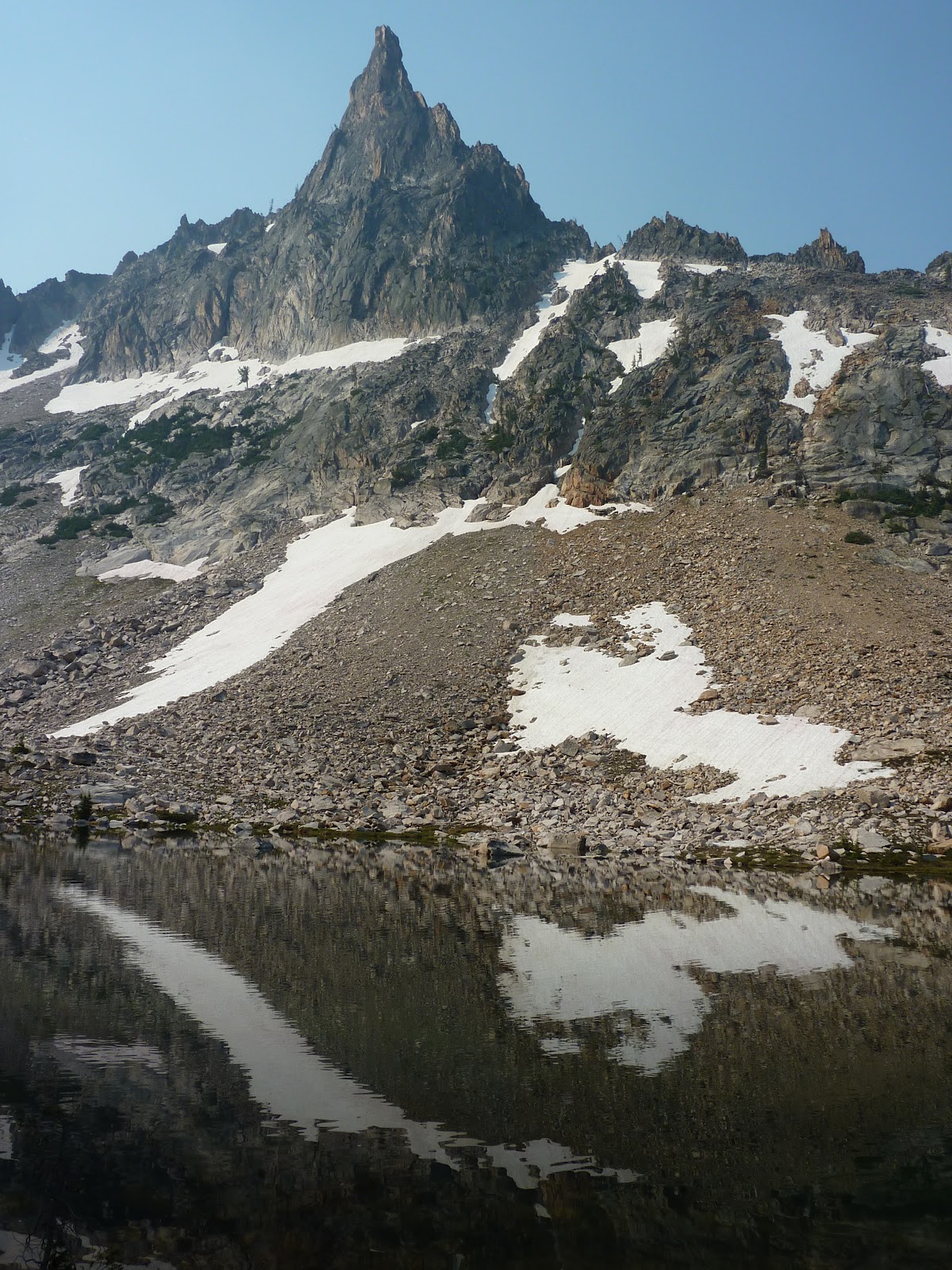 I still, after all this climbing and knowing where I was at last, nearly picked the wrong pass to climb to. Again the reason was: the actual way seemed inconceivably bad. It was a terrible trip down, though not so bad getting up from the Warbonnet Lakes. But then I spent more hours nearly breaking ankles and tripping and sliding and having rocks tumble after me down steep dry and wet nasty slopes. I let out some roars or pure alchemic rage which again shook the mountains and were only half-formed syllables, something like the letter "G", and if I had the energy, the next sound may have been close to "Zeus". But I was too out of breath to finish the curse, or the expression of amazement. How could terrain be so crummy so consistently and still be travelled by people willingly every year? The ice was better. The whole result was a disaster for me. I can't imagine ever going back, though there are amazing pics of the area. I think it would be better earlier in season when the peaks were more snow-covered. Ice is more stable than the rock in the area, if that is believable. But still, I got there, and that is something.
Back at Alpine Lake, I was ready to leave. I had a whole day plus half more to stay in Idaho if I wanted, but what else would I do? At this point I had done about 40 miles, lots of it up and down, had climbed 7 peaks, most of them impressive but not jaw-dropping, and chased storms, fled storms, been sun-bleached, been rained on, been spooked by animals, been amazed, let down, and everything inbetween. And with a month more hiking coming up, I figured, it was about time to head for home. But I was good and wise and rested 2 hours, eating, chugging fluids, and enjoying the idle pleasure of the Alpine Lake views. Packing slowly, stretching, prowling about in my muckluck slippers to let my shoes air out and give my feet a rest. I felt like a god, or a demi-god at least, who had escaped all of the modern world, like a time traveller who had not heard a phone or a horn or a car motor in a week. I was dirty, and glad to be done with all the hard stuff.
The pack was light on the way down now as most of my food was eaten and I wanted to make quick work to the boat shuttle. I decided to aim for the 7 pm and if I missed it, to camp near the dock for the 9 am next morning. I started at a little before 4. At 6, I was at the dock. I moved pretty shockingly fast for it being the end of the week, though it was all down hill, not pausing much and taking few pictures, though I did stop at some scenic falls and to view the creek a few times, as well as an impressive balanced rock. The sky was still hazy but more blue, and I began to doubt whether there were any fire actually. I made my boat and no one was panicking or said anything to me about a fire. When I got home, I found there were a few in the area, though nothing big or which started the night before. So that is still a mystery to me. Oh well. I ate a good dinner, got cleaned up a little and changed into clean non-hiking clothes, and then drove home starting at twilight.
More destiny of a rough sort seemed due me, as deer were trotting across the road at every bend, barely visible. I drove well under the speed limit or would have met any of five or so more personally than I wanted to. I had to stop at the Idaho border 4 hours later to sleep in the car for a bit. I woke the next morning after sunrise with a stiff neck, curled up in the backseat, happy, and laughing. Guess I needed the sleep.


 Well that wrapped up a mostly good trip. But its funny how a little rest changes perspective. Suddenly I was questioning myself as to why I did so little on the trip. Why did I let a mere 45-50 miles and 7 smallish peaks tucker me out and keep me off the good peaks and cliffs around the Feather Lakes? How did I get so lost? Am I really so clueless? Why did I not do more peaks, push through the fatigue? Depression came on as I drove home and ditzy people in big vehicles began swerving into my lane and making angry gestures at me for being there, as if I should know better and leave them the road. I did not like coming back to Utah where it was 80 F at 7 am. Where everything was even more hazy and had a scorched look. Coming back to the reality that is modern life with cars, electronics and all that. But its only for a week, and a good meal and a good rest put me in a better mood. I will just have to go back to the Sawtooths someday, and I have the rest of the summer to hike and hopefully will have fun doing so. The Feather Lakes I think I will skip though. That was a once in a lifetime experience I think. I had all the fun I could stand with them. But go find them if you want some grief or a challenge.
Larger versions of some pics, as well as others, including panoramas, are available for print or perusal at thestillwildwest.com. More stories will come when I am back from my next adventures. Thanks for reading.
Thursday, July 12, 2012
Redfish Inlet Trail and Area
Redfish Lake area offers great camping, trails, food, and adventure.
As always, prints are available over at the stillwildwest.com, and more pictures of Idaho and the Sawtooths are there in the galleries.
After my Alice-Toxaway Loop I was beat. I was very dehydrated, though that came on quikly and my legs were spent from the big rig and heavy pack and I was sick of mountains and wet feet, and dry forests, so I decided to spend a half day at the marina beach of Redfish Lake near the lodge and rest up. The review of the food is on my other blog about food and cooking, youngbrokeandclueless.blogspot.com, which is shared, sort of, with a friend of mine, who no longer posts and rarely talks to me. She's busy, and I'm probably a bit too much of a jerk to stand in person for long, so that's that.
The marina was fun. I loosened my legs by swimming in the cold waist-high waters and running forward, backward, and sideways. And I enjoyed the views of mountains and fit people, or at least, people who were not morbidly obese and disgusting to themselves and the dignity of the human form. Congratulations Idaho, that was the least waddling I've seen in a crowd in a long time. Probably it is a coincidence that I saw only one fast food restaurant in a 150 mile stretch. That can't have anything to do with it.
 I camped the night and made some decisions for the gear on the next trip. Mostly I decided my green thin sleeping bag is too thin to bother with taking into the mountains. Sure I save 2 pounds and lots of space in the pack, but I also run a risk of freezing to death. So its for summer only now. Sleeping in it by the lake, in a tent, was awful. I was very comfortable until morning, then got bad chills. The moon in the Sawtooths was so bright that the night held off until around 10:30 pm, and when I awoke multiple times to run to the outhouse- I drank near a gallon of fluids to refresh myself- I patted the sand thinking it had snowed. The whole world was white and glowing. Very neat.

 I felt strong in morning, and packed, and ate and tried not to forget anything for once. I took ice axe and crampons and rock shoes this time, along with the marine bag, and no tent, which traded about 6 new lbs of stuff for about 12 lbs of stuff I left behind. Then I made for the 12 pm shuttle boat across the lake. Round trip is $16.00, and many climbers complain about the price and the time of the runs- 9 am, 12 pm, 3, 5, and 7 pm. But I think that is pretty reasonable. Your alternative is to hike 5 miles each way extra around the long dry hilly sides of the lake, through pine forests touched by that scourge, the asian beetle. Not worth it, I say. I chose the boat.
 As for the trail, it is hot, though shaded, and doable any time of day. It is hilly, but pretty, not ravaged by beetles in most spots, with 21 long switchbacks to Alpine Lake- a beautiful spot, though the forest is badly thinned and the trees are all dying- shown above from the south and north shores. Mosquitoes are plentiful and other hikers will abound, but still, its a great destination for a day. I took 3+ hours to get up there, and made it down in 2+. Elephant's Perch is another popular spot where you can probably find climbers gearing up and heading up the huge walls. On my first day, starting at noon, I decided to press on and over Baron Pass, where I wanted to finish at Baron Lakes. I did that pretty easy, getting there at 7 pm just as some rain started to fall and having climbed one peak at the pass- the dark interesting peak with clouds all around me. I took a panoramic movie to show how silly it was probably to be up there, though I read the clouds perfect and got down the pass just as the rain started. It was a challenging climb, with several tricky and exposed moves, and most people should not try it, at least without a spotter, though you do not need rope, and I did it without the climbing shoes, though those would have been safer, and smarter.


 Baron Lake was pretty, though crossing the spring creek was a trick, and I got my feet a little wet as the log bridges were all unsteady and part submerged. I got eating and found shelter under some trees that stopped most of the raindrops, and munched away as a distracted deer came sniffling right up to me with only a large boulder between us and starting licking my sweaty socks I had laid out as I watched. She looked up and about jumped all off the ground to see me there. This was one emaciated deer. I wanted to throw her a cookie, or a dorito, but what she really needed was salt. That night she and a friend kept coming around and eating within 5 feet of my ears, tearing up the ground for roots and shrubs. They are ready for summer and blooming I am sure! Deer are not very quiet creatures, nor very alert ones, when you are used to the woods. I always wondered how Indians could shoot them with arrows, as they are skittish. But I generally know they are there long before they know I am near nowadays. They crunch leaves and branches, clop around gracelessly on their hooves with a kind of shuffling amble when not fleeing, and walk with their noses to the ground. Unless the wind carries your scent to them, they really will walk right into you. And I can sneak up on them when I want. Deer are also hard on a forest, much worse with their hooves than a good hiker is in boots on the soil and mud and vegetation and they dig and tear and chew anything. Its easy to see why population density with deer will destroy a forest and they must be hunted. They are also noisy eaters and kept waking me, and for starving beasts, they wasted a lot of energy running a mile away in a panic every time I grunted or stirred when they woke me, then ambling back to eat leaves again. Its easy to see with that kind of energy trade off, why they were starving! So there goes the myth about deer being the gentle majestic queens of the forest.
 Morning brought the usual Sawtooth specialty: a 5 minute red light spectacular to the cliffs before it disappeared. You have to catch it at just the right moment or it will think the whole day was ugly and the cliffs washed out the whole time! I was looking at a waterfall and had a lake on the map that I wanted to try bushwhacking to, and thinking the waterfall must lead me to it, and seeing a shelf up above the fall, I made for it. There was a trail leading me much of the way, and I passed a stock tie up, so I guess this little shelf I was on between lakes is meant to be accessed by the riders, and that did make things easier. I found the falls and followed them getting lots of good shots and making for a wild peak up above me, which I thought for a while was the famous Warbonnet, but finding I was wrong as I closed in. Also I picked the wrong shelf for the raised hanging lake. I did some ice climbing and eventually found the lake, though only from a distance, as I did not climb further. The lake was near frozen completely anyway and looked about like the ice field I had been on. I was disappointed to waste half a hard morning, so I decided to get to a peak up above me.

 I worked my way up hard scree, with some small slides going below me, and made glacially slow moves- the kind that are safe but tedious, and which carved out these peaks originally. I slowly gained the ridge, and made my way to a peak, not one of the highest on the famous Monte Verita, but jagged enough and tricky enough to sort of make the time worth it. Plus I didn't want to head back down the long swerving route I'd taken yet and was dawdling. I should have used the rock shoes as I had them and had carried the weight, but I only made 4 moves that needed them. The exposure was terrific, as I had to go sideways across some very narrow vertical-ish boulders stacked together, and could only slap the final rock, as it was overhanging, but it was something. Several hours of about the same got me back down, though I nearly cliffed-out twice (where going down further is impossible) trying to save time and make short cuts.

 I snacked and dried off at my lake, and mulled over going back up another route of Monte Verita to the highest point on the ridge, overlooking the Feather Lakes. The route was cool, but mostly a walk, and it was high noon, and would have taken the whole afternoon, been hot, and left me with very bleached photos. I decided against it. I wanted to save energy for Feather Lakes and had to go back over the pass that day. Baron Pass was similar to the Pass near Snowyside Peak on my other route: the North side was snowbound and slippery and melting fast, making for danger and not much fun. So I took my time, and kept water near at hand.


In the above pics, you can see the actual Warbonnet- is there a more aptly named mountain in this world? And on the right, is the final "ledge"/ridge over to the tilted pointy stone that I slapped and was my summit for the morning.
For the afternoon I planned to head to the Feather Lakes, hidden lakes located in a maze of high peaks surrounded by other high peaks, by going over the ridge near Alpine Lake. There is no pass, no trail, and none is possible, as the ridge is nasty, steep, and rotten. I will save all that for the next post, coming soon.
As always, prints are available over at the stillwildwest.com, and more pictures of Idaho and the Sawtooths are there in the galleries.
After my Alice-Toxaway Loop I was beat. I was very dehydrated, though that came on quikly and my legs were spent from the big rig and heavy pack and I was sick of mountains and wet feet, and dry forests, so I decided to spend a half day at the marina beach of Redfish Lake near the lodge and rest up. The review of the food is on my other blog about food and cooking, youngbrokeandclueless.blogspot.com, which is shared, sort of, with a friend of mine, who no longer posts and rarely talks to me. She's busy, and I'm probably a bit too much of a jerk to stand in person for long, so that's that.
The marina was fun. I loosened my legs by swimming in the cold waist-high waters and running forward, backward, and sideways. And I enjoyed the views of mountains and fit people, or at least, people who were not morbidly obese and disgusting to themselves and the dignity of the human form. Congratulations Idaho, that was the least waddling I've seen in a crowd in a long time. Probably it is a coincidence that I saw only one fast food restaurant in a 150 mile stretch. That can't have anything to do with it.


 As for the trail, it is hot, though shaded, and doable any time of day. It is hilly, but pretty, not ravaged by beetles in most spots, with 21 long switchbacks to Alpine Lake- a beautiful spot, though the forest is badly thinned and the trees are all dying- shown above from the south and north shores. Mosquitoes are plentiful and other hikers will abound, but still, its a great destination for a day. I took 3+ hours to get up there, and made it down in 2+. Elephant's Perch is another popular spot where you can probably find climbers gearing up and heading up the huge walls. On my first day, starting at noon, I decided to press on and over Baron Pass, where I wanted to finish at Baron Lakes. I did that pretty easy, getting there at 7 pm just as some rain started to fall and having climbed one peak at the pass- the dark interesting peak with clouds all around me. I took a panoramic movie to show how silly it was probably to be up there, though I read the clouds perfect and got down the pass just as the rain started. It was a challenging climb, with several tricky and exposed moves, and most people should not try it, at least without a spotter, though you do not need rope, and I did it without the climbing shoes, though those would have been safer, and smarter.


 Morning brought the usual Sawtooth specialty: a 5 minute red light spectacular to the cliffs before it disappeared. You have to catch it at just the right moment or it will think the whole day was ugly and the cliffs washed out the whole time! I was looking at a waterfall and had a lake on the map that I wanted to try bushwhacking to, and thinking the waterfall must lead me to it, and seeing a shelf up above the fall, I made for it. There was a trail leading me much of the way, and I passed a stock tie up, so I guess this little shelf I was on between lakes is meant to be accessed by the riders, and that did make things easier. I found the falls and followed them getting lots of good shots and making for a wild peak up above me, which I thought for a while was the famous Warbonnet, but finding I was wrong as I closed in. Also I picked the wrong shelf for the raised hanging lake. I did some ice climbing and eventually found the lake, though only from a distance, as I did not climb further. The lake was near frozen completely anyway and looked about like the ice field I had been on. I was disappointed to waste half a hard morning, so I decided to get to a peak up above me.


In the above pics, you can see the actual Warbonnet- is there a more aptly named mountain in this world? And on the right, is the final "ledge"/ridge over to the tilted pointy stone that I slapped and was my summit for the morning.
For the afternoon I planned to head to the Feather Lakes, hidden lakes located in a maze of high peaks surrounded by other high peaks, by going over the ridge near Alpine Lake. There is no pass, no trail, and none is possible, as the ridge is nasty, steep, and rotten. I will save all that for the next post, coming soon.
Subscribe to:
Posts (Atom)