Showing posts with label danger. Show all posts

Friday, August 24, 2012

The Brothers and the Valley of Silent Men

My final hike in Washington is a good story, and the pictures were more easily sorted through than other legs of the journey, so I am going to write about it.  I apologize that photos posted in a jumble and I am not fixig them any further.  If its trees, its the Valley of Silent Men returning from the Brothers.  Not trees are on the Brothers.  Now, after a 2.5 day, 2 night big loop through Sol Duc and some high trails, I drove the long and ghastly way (construction zones, bleak towns, tedious weaving roads, tourist trap mainstreets) to Hamma Hamma Road, it of the cute name, skipping other sections of the park with desirable mountains due to roads being washed away, or access roads being twisty, sketchy, and dirt or gravel.  I'm trying not to abuse my car as I used to, since my car is now almost not a "teenager" anymore, and once a month, won't start without some Jedi tricks.  I have had this checked out and all I can get any mechanic to tell me is that my car is fine and not only fine, but a marvel, and the envy of new car owners who have more problems than me.  A fun story I may not have mentioned from Glacier: a fellow had to have his hopped-up pimped-out $35,000 country boy truck towed for $400 on a flatbed, then found out the reason it would not start was that his vibrator/heated seat was shorting out the circuit the starter was on, and as soon as he moved the seat back, the circuit reset and his truck was fine.  Yeah, I like a car that I drive, not that drives me.  I don't want any special robot nano-satellite linked artificial intelligence add ins, I just want to get from A to B.  And actually I am happier the less driving I do.  But road trips require it and I've climbed and hiked every decent peak within 50 miles of where I live.

Another aside: while in Olympic National Park, which is not it turns out, the whole peninsula as I thought, there were signs everywhere telling me to vote against national park expansion and to vote for working families.  Blah blah blah, apparently, so far as I could make out: the government wants to forcibly buy more land from people currently living in areas sort of inside the park.  These homes were there first.  Now, I found it odd passing through neighborhoods in a rainforest, but Olympic National Park is already pretty big.  Many of the mountain trails require 25 mile approaches.  That is not ideal because the legs are burned up by the time you start going up.  And few people do it.  Mostly, I only saw people within 1 mile of trailheads.  So why exactly does the park need to be bigger?  This is one park I say is plenty large enough, especially if 5 years after a flood, I still can't get to the Doswallips peaks because the road has not been repaired.  Washington seems to do a pretty good job running their forests, and every forest I saw looked danged healthy, though there are some ugly clear cut spots on the hills.  These are rotated, and my jokes and grievances with the logging trucks aside (I forgot to mention about Mt St Helens that while permits to climb the peak are strictly enforced and limited that 2 of every 3 vehicles I saw was a truck loaded with timber; and my bootprints are going to destroy the area?!  Also the ranger I mentioned giving a talk said that elk hoof prints churn the soil and promote regrowth and they are hoping more elk move in.  Yet there are signs all over to not stray from trails.  Again...how are my boot prints doing so much harm?  Wouldn't they churn the soil and promote regrowth too?  To a point?  As long as a million people don't visit per year, which they do not.)

Well, so Hamma Hamma.  Got there on a Tuesday night, a good time to arrive as Lena Lake TH parking is supposed to get fierce and competitive and the area sees lots of campers.  On-line info I had, which was scant as I don't research much, said I would walk a pretty much flat trail 3 miles with a bunch of obnoxious fatso families carrying coolers full of beer, then camp at a lake teeming with idiots who draw bears in with their improper food storing knowledge and that I would be unhappy, but hey, its better than carrying a heavy pack 7 miles to the foot of The Brothers.  So I packed my huge blue rig, the bag that weighs 5 lb empty due to steel rods in it, the kind everyone carries which I've abandoned because it blows out knees and burns up legs and lungs, all so I could carry my tent.  After all, it was only 3 miles.  Then I hit the TH, gorging on fattening soups and peanut butter of course, and read the description and look at the route map and see a whole lot of switchbacks.  Well, that trail is disgusting, heinous, and long and hard and hot.  You go up 1900 feet, its all switchbacks, with no views, and then you actually descend to the lake, so you probably go up 2100 feet.  Its not fun with a heavy pack.  I sweat through my clothes and was pushing dusk.  The lake is ugly so far as lakes go, or at least, was unimpressive. Camping was good, with toilet facilities, toilet paper (a first in Washington!  Hurrah!), nice sites, grills and fire pits provided.  I could not take the storing of food all that seriously when grills were provided though.  Really?  I should worry about bears?  When grills, which absorb flesh over every barbecue for years and are never cleaned and send out very strong odors are right here.  Please.  If bears were frequent to the area, there would not be grills.  But marmots were sneaking about my tent, so I was glad my food was creatively hidden under a log with moss thrown over it 50 feet away.

I was beat but got up dutifully early next morning, expecting a grueling time of it.  I had 3 miles of the Valley of Silent Men between me and the start of the (allegedly) 1.5 miles and 3500 feet of The Brothers.  The Brothers stand 6800 feet above sea level and the trail up to Lena Lake starts at 100 feet.  So there is almost as much up as one has to up at the Grand Teton.  Morning in the Valley of Silent Men was creepy, with no sound at all and little light.  It was ugly too, which disappointed.  I made rapid work of it, stopping for plenty of water as I did not know when my last water for the day would come.  Passed a couple of heavy sleepers who did not stir when I was 2 feet from their tent, laughing at their hanging of food from a tree: 5 feet off the ground on a branch a marmot could easily climb.  So they make their food conspicuous to a bear and accessible to a marmot.  Bury it under a rock and you'd be better off. The family next to me at Lena Lake had been doing the same thing, but I sufficiently stared at them with awe that they knew something in their technique must be wrong and moved to where I could not judge them.  I watched many people hang food in Washington and have watched it in Idaho too, and I never cease to wonder: why?  Buy a bear canister.  It hurts to pay for it the one time, but it adds little extra weight to your pack.  Lord knows most of these people are already carrying 50-80 pounds, so 3 lbs matters?  It keeps your food dry, organized, not smushed, provides a seat in camp, is waterproof, and saves you the 15-30 minutes of daily work every time you set up camp for the rest of your life.  And bears can't get your food, nor marmots, nor rats, not bunnies, nor leprechauns.  I resisted the bear can, but now I take it even when not in bear country.  It makes packing and unpacking way easier.  Enough said.

My attempt at The Brothers was an old-school one.  I had a puny and insufficient map which told me little other than at the end of a 6 mile trail to the Northwestish were 2 large mountains named "The Brothers."  I did not pull it out all day.  I had read enough and viewed a few pics to have the following advice in mind: "when in doubt, go right", and "your options are steep snow, or steep rock, just grab a gully and go".  My impression was this would be a climb at some point, you know, like up cliffs, and slabs, and so I wore my approach shoes, a low cut hiking shoe with sticky soles, ideal for leaping, springing, jogging, well really any move, but not for carrying a heavy pack 3 miles to a lake, and not for sinking into mud or scree.  These were the wrong shoes.  I will not go into a complete detailed description because less than 500 people per year make an effort at The Brothers, I expect, but I will provide generalities.  There is a trail all the way to the summit (s), and to a saddle I wound up on.  These various faint trails are not maintained, but neither really is the trail through the Valley of Silent Men, despite what the park claims.  There are ribbons blazing the way through the valley, and you will need to climb over some large fallen trees, do some route finding, cross a creek probably once without a bridge, and go around some washed out sections of cliffy trail.  Its easy to follow, if you follow faint trails for a living, like me, but if you are an occasional hiker, take your time and look for ribbons and cairns.  There are ribbons blazing the trail all the way up The Brothers too.  Some are orange, some silver, some pink, most red.  They stand out if you know to keep looking for them, but there is room to get lost or stray between them.  There are cairns where ribbons cannot be hung.  Some tape has been put down where ribbons could not be hung; strips of red or orange as Xs on rocks.  These will get moved about.  The route is intuitive once you have done it, not before.  Do not listen to anyone who says the route is intuitive the first time.  I've climbed/hiked near 100 mountains and have never been so lost as on The Brothers, and if you heard about my experiences last year with a couple of 18 hour days and 4 mile creek bushwhacks, then you know that is saying something.  There is no climbing involved, unless you are playing, or lost.  There is scrambling, and steep hiking.  You cannot pick out the summit(s) of The Brothers.  There are a ton of jagged peaks and spires which from various angles look like the high point.  Don't bother unless you know which one is really the true high point (again, that means prior experience in the area).  In spring or early summer, you would follow ice channels and snow up for a long steep way in cleats with an axe.  In August, its a gully run.  You follow gullies up the whole way for quickish climbing and will have to leave them now and again to avoid melting and dangerous snow.  Do not bring climbing shoes, or wear anything other than ankle-supporting clunky boots.  Not doulbe plastic, but solid hiking boots.  Something you don't mind getting dirty or scratched up.  Also, wear pants.  There are thorns, fire ants, hornets and that ilk, thick brush, fallen trees, avalanche zones, fire zones, jagged rocks, and more.  Long sleeves are good too.  Water is available the whole way, every 1/2 mile or so at least and almost up to the summit(s).  A straw filter is ideal as a backup as some pools are too small to filter from, but if you have a straw type, as pictured below, you can slurp up a sip anytime you need to, in under a minute.  In late summer there are some ice caves to cool off in.  Use them.  They are cool.  And at the first one, you need to go left, through the burn zone.  Do not try the mossy slabs and cliffs, and the trail traverses through the worst of the fire zone.  The route is actually two gullies.  Leave the first and connect to the second to the west.  About 1/8 between, I think.  This was where I got most lost and did the most wrong things trying to find a route, since I did not know there was A route, marked the whole way, and the only real plausible single way up, give or take some straying.

Go to frontier-filter.com for the straw filter I describe and show, or find an Emergency Essentials store or type of store near you.  I paid $6 for mine at one of Utah's many disaster preparedness stores.  This model filters up to 6 gallons of water, and is ideal as a backup (1 oz!), or as a cartridge saver, which I am now using it as more and more.  Basically, using any product ruins it, but with a water filter especially, the dirtier the water, the faster you need a new cartridge.  So when I'm looking down at a mud hole now, I use the straw even if I could fit the filter in and pull out a liter.  A new cartridge is more than a new straw Frontier Filter.  This will stop working when shot, by jamming.  So if you suck and nothing comes out, throw it away and buy a new one.  Or replace it every 6 months of hiking or so rather than trying to keep track of how many swallows of water you've taken and how many gallons that adds up to.


You can camp on The Brothers.  There are campsites at the end of the official trail which are nice and near water, but I also found camp signs very near the summit.  Again, there is water the whole way, so this can be done.  Do not carry a heavy pack, or even a tent.  Unless you are going for a week.  Near the summit(s) there are many walls, spires, and towers which would make good day climbs and short adventures for a few hours.  Frankly, for all the misery of going up there, you ought to savor it and make it worth the stress on the knees.  And at one point, I just said "screw this, water knows how to get down, so I'm going to follow these waterfalls", and I did, going up steep wet rocks, which was a real change from going up steep dry rocks and dry gravel for the last several hours.

I spent 14 hours round trip leaving from Lena Lake and returning there, with about 800 calories of food and drinking about 1/2 gallon of filtered water, which was not enough.  The trail is hot, exposed, tedious, and torturous and it sucks until the very end.  Again, if you are climbing, it should be for play.  It won't get you anywhere near the top.  I had to backtrack almost every cliff I did and some of those were hard.  The rocks are often slippery, and when not, are crumbly.  The character of every gully is different.  The main gully is the one to follow, as it leads all the way.  Stay close even when you have to get around the snow.  As for when in doubt, go right: I'd provide this rule: When in doubt, go right, then try left, and then check the middle.  Probably they are all bad options.  If you are stupid, stubborn, or can't bear the thought of returning to your life as a mild-mannered, average-looking middle-class nobody, then keep forcing your way up, if not, turn back like most climbers do, and lie.  Say you were on top but your camera jammed, or lie that you ever tried to do The Brothers.  Also I would add that no one should try to solo The Brothers unless 2 or more of the following apply: 1) you are a psychopath, 2) you already drove all the way to the trailhead to meet a friend and your friend never showed, then you got a text saying your friend died and to honor your friend's spirit, you proceed alone no matter the risks, 3) you want to die, 4) you have a lingering grudge against your knees because your knees stole your best friend's girl and then broke her heart after impregnating her and refusing to pay the abortion so you want to destroy their cartilage as fast as possible so they can't ruin the lives of anymore sweet young maidens, 5) you are one of the greatest mountain climbers alive and want a challenge, 6) the thought of returning home after being wild and free for 16 days is repugnant because you like being dirty and are at home a mild-mannered, average-looking middle-class nobody who was supposed to be a big deal according to standardized tests and the opinions of every grade school teacher you ever have but enjoying life and climbing mountains and writing poems you don't let anyone see because "Van Gogh never sold a painting" sounds like failure to these people, whom you mostly avoid anyway, and didn't ever like much even, but still! 

I will let you decide which of them applies to me.  Did I make it to the top?  Well I did, but my camera jammed...nah just kidding.  Its shockingly worth it for these views and for having clouds brush and waft slowly through your outstretched fingertips:


Film does not do them justice.  I did not think anything could redeem that slog.  I went up moss-covered cliffs, hacked with an axe through a burn zone of dead and falling trees, tripped and fell more than I ever have on any trail (other than The Secret Garden Trail at Sol Duc two days before), got bit by several kinds of things, lost a half dozen times, even on the way down, almost fell off a couple of cliffs (more so than usual), got cliffed-out multiple times which is the worst, had to invent several moves to make it back down some of these danged gullies and cliffs, and hated every minute.  I kept thinking of a Michael Jordan interview where he said the first championship was not the hardest though it took him 7 years and everyone said the whole time he was over-rated and would never get one, and couldn't do it, the last was the hardest b because he already had 5 and it was easier to rest on his laurels, and he had to fight with himself to find the hunger and not be tired.  I felt like that.  I had every reason to turn back and give up.  I meant to a dozen times, but then I started to smell the peak, and it didn't matter that I had done 12 mountains and 150 miles even without these summits, I just started yelling at the mountain:  I will not give up.  You will lose.  I don't care if I die.  You'll have to kill me.  If it takes me till sundown, then I will camp up here and dance all night to keep warm like John Muir used to, when he had no sleeping bag and it started snowing and his friend got frostbite and lost a foot.  Nothing will stop me.  Tell me I'm the best you've seen.  Tell me I'm the clumsiest but I try hard.  Tell me I'm the dumbest.  Tell me I'm something!  (Clearly, I was either overheated or I have emotional problems, but then we all knew this since I solo climb mountains most professional climbers do in teams with safety gear and rappel down)

But it was all worth it on top.  Again, did not think that possible.  I wish I had had more time up there.  The descent went much much faster and was not so bad.  I divided the whole way into little segments, which is the way to cope with bad situations.  My friend, the last time I went out with someone, was very impressed.  He was thinking: its getting dark and we have 8 miles to go, we're lost, the conditions are bad, there is no water on route, and we're both worn down and we will never make it.  And I would say, well its not even a quarter mile to the end of this snowfield.  And we made it, eventually, at midnight, after 18 hours.  And we still talk.  Sort of.  So I divided the long painful slog into sections.  Get to the bottom of these cliffs and then things aren't so bad.  1/4 of steep sliding scree to that second ice cave, then 1/2 mile to the first one.  Cool off and get some water at those.  Then back to the fire zone...and so on.  I knew the way now.  The only real adventure was a goat stalked me.  This lady goat watched me starting slides with each step down the scree, and I thought she was thinking: "what a clutz!  How much noise!  I always get the worst neighbors!"  Then in the ice cave, the whole world began to shake and I froze and thought: avalanche!  Do I stay in here?  Will it hold?  And what do I see?  That goat leaping out of the way after triggering it.  So maybe she was thinking the whole time that I moved good for a three legged goat (I had my alpine axe and was stopping all my falls with it).  Then she came to the mouth of the cave and stared at me, so I moved, she stepped in to cool off and get some shade, then followed me.  This went on for a half hour and 1/4 mile of the gully.  She got very close several times and even passed me once and all the while blinking at me, with flies taking her apart.  I finally made some quick climbing moves that spooked her to go away, or convinced her I was not just a shy three-legged potential mate but a man-cub, or some other goat boogy beast.  But it creeped me out.  Okay, you're lonely, I get that, your biological clock is ticking, but come on.  I had to keep close eye on her horns incase she went crazy and charged me, and I was glad once again to have that alpine axe there.  A fine weapon when needed.


Above: My goat stalker becomes the prey.  She proves she trusts me by turning her back to me while contemplating the long way down I had to go yet.  The Valley of Silent Men starts heading West (to the right) where the trees meet the creek long past the burn zone at the foot of the facing mountain.  Perhaps she was trying to express with body language: "the way is long, hard, and unpleasant, stay with me, we will go bowling," or some such feminine mystique.  This may have been the Jane Austen of mountain goats for all I know.  The close ups are not zooms.  Animals, eight year old girls, and married 40+ year old women love me!  Everyone else...well my mom says I'm cool.

The campers were gone when I made the river, but the Valley of Silent Men now had late evening light and was gorgeous!  A wholly changed environment, not sinister now, even when the creek went underground and the air became echoingly still.  Most of my pictures did not come out as it was too late.  There is one gorgeous waterfall in the area, and lots of mossy mounds and nursery logs (old trees now sprouting with grasses, moss, flowers, and new trees as they compost), which can be had in other parts of Olympic and Washington and Oregon, but I was really floored with hills of ivy and some of the spots I passed through.  These are the few photos that came out decently.  I was pushing dusk again when I hit Lake Lena and stayed up eating until about 11 pm.  I knew my next day was just hiking out.  I had planned to go 10 more miles round trip to do Mt Lena, which offers the best views of The Brothers and can be approached from the camp I already had, but my knees were done.  I woke up having a dream I was being tortured actually and had to slowly straighten my legs.  Then I rested until noon before packing up and heading down because my knees and feet needed it.  Actually 10 days later I am still moving around like Bruce Wayne in the latest Batman movie, before he, you know, grows new cartilage and becomes Batman again with the cane forgotten, before his back gets broken and an Arab played by a white guy (one of 3,000 in the film) punches his back whole for him so he and his regrown (is that even possible?) cartilage can make the leap of faith and save Gotham on the very last day at the very last hour of 5 months after being saved by Catwoman at the very single instant when she could do so without killing both Bane and the other chick but before she was too late...not that I'm questioning that movie, not at all.


Actually, I'm glad to be limping around.  If I'm not injured, then how hard did I really work?  And was anything I did really worth it?  Funny.  I just read some guy/kid's trip report of solo climbing the Grand Teton, one spot I'm heading next, and saying he thought the idea was insane and he would die, and then after he did it, he thought, well if I did it, it can't have been hard and I shouldn't be proud of it.  That's how I always feel after a climb too.  Maybe everyone feels that way, and its coming down from the adrenaline.  But The Brothers were a great send-off.  I was able to keep pressing because they were last.  I made them the grand finale.  Had I gone there first or in the middle, I'd have quit and saved my legs.  So I am proud of those peaks.  You have no idea what it took to get these pictures...well I guess you do actually.  Missing Mt Lena was not too big a deal.  Some chubby whiny girl had sprained her ankle at the lake and was milking it, sobbing up a storm and making every stranger wait for her.  I refrained from sharing any of my pagan and old-world suck-it-up suffering makes us better philsophies.  I made some friends too.  A co-ed doing surveys for the park and a nice man who kept calling himself fat and wanted company after not reaching the lake before giving up (recent heart attack and his doc said stop when you get chest pains, but get active) until I mentioned I was from Utah and then he said if he didn't manage to lose the weight he wanted to, he could just move back there and look thinner.  So we shared Utah jokes.  And I think I embaressed him a little when I told my co-ed surveyer that I had put in 14 hours screaming and sweating to the top of The Brothers and that I refused to turn back for anything.  But mostly we shared Utah jokes.  Good times.

Seriously, last warning: The Brothers is not only not for anybody, but not for most.  The Valley of Silent Men is not named that on maps, but is appropriate, because silent, and frequented only by rugged mountaineers, not men of many words...before the advent of blogging anyway.  To visit the Valley, camp at Lena Lake and spend an afternoon there.  The last mile of trail is the best section. 

Wednesday, August 22, 2012

Mount Rainier National Park and Multnomah Falls area

Having spent a full day at Mt St Helens unplanned, I needed to move quick at Mount Rainier, and I did not have the legs for it.  Prints available for any of these, and others over at my website, for any interested.  Or steal them.  How will I know?  Its sort of a victimless crime.  Unless you believe in Karma, and that the universe, when being formed by it, anticipated the internet.  Mormons seem to believe Jesus does not apply to the insides of cars, I've noticed.  They'll run you over after holding the door open for you coming out of church.

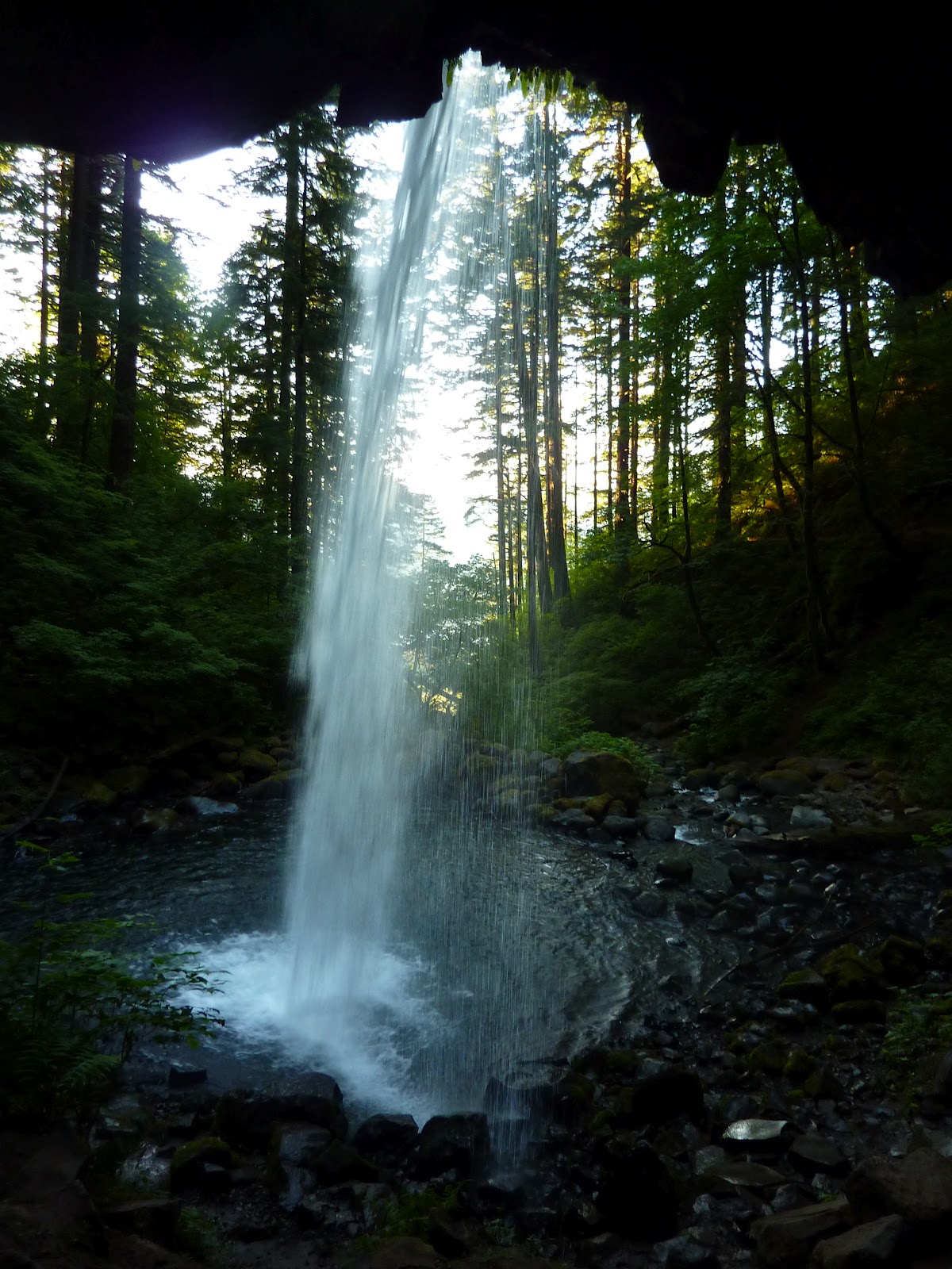
My plan for Mt Rainier was to hit all the different areas of the park: Paradise, the Tatoosh Range, Steven's Creek, several waterfalls, and then Sunrise on the North side.  I had to drive several slow winding hours from Helens which ate up the very early morning.  I made one stop at the Iron Creek Falls, which are beautiful, easy to access, and look like they could be on a tropical island.  Stop if you nearby.  I also include here pictures from the Multnomah area, as I am not going to post for them separately.  These falls I visited on the evening of my first night of travel, after driving 800 miles and 12 hours.  I had too little time and some of the falls did not come out.  Multnomah is the most famous and has a bridge across the view, and is photographed 10,000 times daily.  These falls are Ponytail, Horsetail, and Lower Oneonta.  The Lower Oneonta is waded to through a creek, which I tried the previous May on a cold raining morning, giving it up when I would have had to swim a 10 foot deep section and I could not feel any part of my body.  I was hanging on the walls of the steep gorge to get my feet out of the water periodically.  So the hike was unfinished business for me, and I actually headed to Portland first just to make sure I got this in.  Nothing was going to deny me, even the still-icy water being 4 feet or more deep, which I just plowed right through.  Luckily, my untested waterproof bags held and my Ipod, phone, and wallet suffered no damage, but I got cold.  Most of the pictures did not come out, but its a gorgeous short little adventure, if you can get around a huge log barrier at the start.  Wear water shoes.  I bought a new pair just for this hike earlier in the day, and was lucky to find some in Boise at my one stop of the day other than gas stations.  I had realized I'd left my pair at home in the closet.  Sigh.  Multnomah Falls area and trails remind me very much of Starved Rock State Park, Illinois.  The geography is the same.  Surprisingly so.  The river, the overlooks, the trails, the canyons.  If I mixed pictures, you'd have a hard time knowing which came from where, even having been there.  I suppose these falls do not freeze in winter like the Starved Rock ice falls though. 

Well Paradise area of Rainier is awful.  I hated it.  I was a few weeks early for the peak of the flowers but all the trails are steep, paved, crowded, and you have swarms of "mountaineers" being instructed in ice technique in gear way too good for them as novices that will rot in their closets after and cost hundreds of dollars.  They are clunking around on paved trails in these boots I'd blush to own, though I've gone up more glaciers than the lot of them put together will in a lifetime.  Not much there but a lodge and a gift shop.  I beat it quick, though I did get inspired looking at the Tatoosh Range.  That was my next stop.  I found by the map I'd need to backtrack quite a ways to see waterfalls in the area or Eagle Peak and its trail, and with the day already warm, I gave it up.  I figure enough people take pictures of all the waterfalls in Paradise.  I did take a few pics of the ruined gorgeous falls "Sluiskin Falls".  The Park Service has thoughtfully erected a bridge right across the falls to ruin the shot for you and you won't see it anyway for all the professional photographers hanging out menacingly and staking spots.  But if you push through some trees to a cliff edge you may get a single picture that looks natural and is unique.  As below.  Personally, my advice is skip Paradise entirely.  Its where all the cars and hikers are, so enjoy the rest of the park in solitude.

There are three main trails into the cute small Tatoosh Range of mountains south of Rainier.  Eagle Peak Trail is the longest and accesses the Western end near Longmire.  I missed that trailhead and so started at Pinnacle Peak Trail.  This is a short and sweet trail up to a saddle between steep Pinnacle and another peak named Plummer.  Also accessible is "The Castle".  A popular climb due to a pitch or two of sheer rock.  The trail is short, climbs little, and easy.  Pretty views abound of Rainier, certainly better than at Paradise.  The trail is pleasantly peopled with a few groups on weekdays, it seems, though not many.  Enough to talk to, not to be crowded by.  I saw a mountain goat from afar eating on the side of a sheer wall.  I was impressed.  The trail will be patchy with steep snowbanks melting out until at least August and just assume some will be there all year.  They are hazardous, so take poles or alpine axe.  I had cleats too, but never broke them out, though when on this cliff pictured below, it suddenly struck me that I am perhaps a little over-acclimated to mountain dangers, as I realized one slip would be serious and that I was skipping across like I was playing on beach sand.

From the saddle I walked the surprisingly difficult and far way to Plummer Peak, which is mostly a trail, but gets bushy at the end, actually requiring you climb "through" a tree and then go over a few jagged rocks for your view.  Lady bugs were up there, being swarmy.  I stayed for a bit admiring the swirling clouds out west over a sea of rolling hilly mountains, and Eagle Peak and its ridge, which looked like good solid rock climbing and made me wish I had done the trail.  But at 3.5 miles and much more elevation gain, its a half day or more adventure.  There was a fabulous pyramid down by "Cliff Lake" which sits between Plummer and Eagle.  Made me want to go there.  To the east are great shots of Pinnacle and the Castle, as well as big Unicorn Peak up above Snow Lakes, another popular trail.  No trail goes to Unicorn, but you can bush pretty easily from the Snow Lakes, with the route obvious or so I have read and the map indicates, as well as what I could see with my own eyes.

I worked over to Pinnacle next, which was looking more serious than I'd planned.  A steep scramble.  Turned into a climb for the last few hundred feet which I did not expect until looking at it.  I'd read some basic info that claimed it was a scramble, class 3, but clearly that is the usual bravado of "pro" climbers, the guys who use rope, special shoes, harnesses, and who will never admit that anything was hard, fun, or worthy of their greatness.  Actually, I've found most climbers are real jerks in my time, arrogant, and about the mental and emotional equivalents of pouting 14 year olds.  They will sneer about everything they do in a dismissive way.  And they will tell you something like Pinnacle Peak is just a scramble, class 3.  Its a 5th class climb for at least 2 pitches.  I found slings left there by pro climbers scared to climb down without rope aid, and I am confident that not many people solo climb that peak.  Its easy 5th class.  I'd say 5.5, but the scramble advice is nonsense.  A scramble, 3 class, means occassional use of hands.  I dare anyone to climb the route up Pinnacle with their hands in their pockets as I did on Angel's Landing at Zion.  That is 3 class.  Its a steep walk, with a handhold now and again.  These climbers, they're the best.  Ask them about Mt Everest and they'd say, "oh its hardly a climb.  Don't know why I even bothered.  Now Mars has some big mountains.  15 milers.  And if Kelty Inc ever invents a decent deep sea climbers suit, I could probably find a challenge climbing the Atlantic Deep Sea Ridge from bottom up without a headlamp, blind, like Aqua Man"... well I had fun.  And though its a soup sipping if you're used to mountains and climbing, its not for just anyone.  There is no route, just pick a line and try not to die.  More great views, with swirls of clouds moving in around Rainier.  Headed down to make a run at The Castle, but things were steep enough that I wanted both hands and stowing my axe in the pack was still in my way, getting caught on rocks and making me do some crazy contortions to free it from snags, which put me at risk of that nemesis of many, Gravity.  I dropped the axe down 10 feet and watched with some cursing as it bounced and sang down 500 feet of broken cliffs- all red, and shining in the sun.  My axe is red, by the way, and shines in the sun.

So I spent the next hour going up and down scree and nasty little crumbly cliffs, 4th class mostly (very steep, but not quite vertical) looking for the thing as I was not leaving it.  Eventually found it hundreds of feet above me, dangling hidden from view except from the very spot I was standing.  Couldn't see it as I climbed up, but kept a straight line and found it.  That spent enough time that I gave up on The Castle.  It was hot, bright, and I had other parts of the park to see.  Did take the time to hack away a lot of melting ice ledges on the way down though so hikers the next day would not fall through and get a jolt if not paying attention.  Skipped the Snow Lakes trail as I did not want to climb Unicorn Peak too.  I regretted this later as I met some hikers who told me the lakes were lush with flowers.  But the views from any Tatoosh Peak will be pretty comparable.  In that regard, Plummer is the easiest to reach for most and will do just fine.  If you have a car shuttle, however, the Tatoosh Traverse going from Eagle to Unicorn and down Snow Lakes would be reasonable for a day.  Or start at Snow Lakes Trail and work West to Eagle Peak and trail, as you would start from a higher elevation I think.  The view is always basically of the Tatoosh range you are not on, and of Rainier, which looks pretty much the same from about the entire state of Washington.  I skipped Steven's Creek due to rampant ugliness that was evident from the road, and tried a short touch of the Wonderland Trail which goes 100 miles or so around Rainier.  This section was very pretty and made me want to come back for more someday.  This was around Box Canyon, which is a deep gorge, very pretty, which I got not one single good photograph of.  A pity!  Looked like a greener version of some gorges in Zion National Park, and a taller version of Avalanche Gorge in Glacier (pictured in another post on this blog).  Then I went to Ohanapecosh, on the advice of some fellow travelers probably reading this right now.


Some crazy tree stumps that looked like wheels and the sun lowering on the Wonderland Trail near Box Canyon.  Above, I wondered what people in Paradise were experiencing, with the clouds probably enveloping them completely.  Too late in the day for anyone but an idiot to be on the summit- coming down would be slide city.


Good advice.  A beautiful old-growth forest with easy trails, The Grove of the Patriarchs especially impresses, with massive trees to rival the Sequoiahs or Redwoods of California.  Also there are creek and waterfall opportunities.  I played on some wet cliffs despite signs assuring me I would die if I did so.  I did almost slip, so don't do likewise, unless you have good shoes and are sturdy in them.  Not much more to say than that.  Silver Falls is not so beautiful, but the hike is short.  I drove up next towards Sunrise, but it was too late to reach it.  Tried some pictures of waterfalls along the road.  Most did not come out.  The drive is pretty though I kept few photos.  Of course, there will pro photographers setting up tripods and one actually whistled at me to let me know I was improperly infringing on his staked claim, or something.  He and a friend were setting up taking hundreds of pics of a fall, and I motioned that I was going to pass by and hike to it.  I then started climbing up the thing, all in under 3 minutes, and he began making angry noises.  Apparently it is bad etiquette to stop the 20 clicks per minute digital photo-snapping of a pro at work, when he has an hour of button pressing ahead of him.  I hate photographers.  I don't consider myself one.  I am an adventurer who takes pictures.  This gentleman was also lucky I was in a hurry, there were others around, and I was not quite as feral as I would be within a week's time, or I might have had some words with him too. I did not even deign to sneer at him though.  Wasn't near crabby enough.  Below is a fallen over massive tree you can look up inside the trunk of.  A grown man with kids walked right into it and made the kind of sound 5 year olds do in an ice cream parlor combo toy store for the first time.  It was awesome.  The tree and the guy's super enthusiastic reaction to it.  I may add more pics of some trees but most did not come out. 


I skipped Sunrise when I looked at the road.  Steep, winding, long, and I figured, not worth it.  I can only do so many slow steep roads in a week's time.  So I drove on, and had a time of it looking for someplace to sleep.  Chose a Walmart parking lot some town or other.  Gave me time to find a replacement bandana for one I lost in Glacier.  I bought 2, and promptly lost one within 2 days.  I still have the other, thankfully, though as far as disasters go, losing $2 bandanas and a washcloth (the only things missing when I got home) is pretty tolerable.

 I will probably have a few panoramas out of these pics on the actual website at some point soon.  Have not developed those yet, but got some decent wider views of the Tatoosh range peaks.  What beautiful weather!  I can't promise you'll see Rainier when you go.  Its often masked by clouds.


Mt Rainier, is, as a former resident of Washington told me before going, Mt Rainier.  But you can have fun and do some exploring at other places.  Seemed true to me.  The area is pretty, but a little crowded.  There are some great trails, but don't overdue it.  Include it in a trip to Washington, or hike all the Wonderland Trail.  You could do worse things with your time, but don't try to cover every single trail in the park.  Mt Rainier, from any angle, is Mt Rainier.  If you are climbing the peak, you get the worst of all worlds: super steep, huge, and more prominence (elevation gain) than any peak on the continent, plus hundreds of even thousands of tourists out of their league, paying guides to keep them alive and on the right path.  Doing annoying and dangerous things that ruin your trip.  No thanks, I don't sleep with prostitutes and I don't climb famous or tourist mountains.  That is one sad irony about mountains though: the best mountains go to those who least deserve and appreciate them, and the most dangerous mountains end up getting the most travel, because people like me who like being outdoors take money from rich jerks to help them despoil places they should not be and could not get to otherwise.  Ah life, it takes the thing you love and makes you compromise it.  Well, next stop was the Cascades, a half day's drive away.  But I stumbled upon Fairhaven first, and spent half a day there, recovering my legs and filling my belly with rich soups and other delicacies outlined on my food blog.  I love Fairhaven.